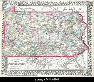
 . English: This hand colored map is a lithographic engraving, dating to 1874 by the legendary American mapmaker S.A. Mitchell Jr. This is a rare representation of Pennsylvania. Pennsylvania.. 1874. 1874 Mitchell Map of Pennsylvania - Geographicus - PA-m-1874 Stock Photohttps://www.alamy.com/licenses-and-pricing/?v=1https://www.alamy.com/english-this-hand-colored-map-is-a-lithographic-engraving-dating-to-1874-by-the-legendary-american-mapmaker-sa-mitchell-jr-this-is-a-rare-representation-of-pennsylvania-pennsylvania-1874-1874-mitchell-map-of-pennsylvania-geographicus-pa-m-1874-image184970873.html
RMMMX46H–. English: This hand colored map is a lithographic engraving, dating to 1874 by the legendary American mapmaker S.A. Mitchell Jr. This is a rare representation of Pennsylvania. Pennsylvania.. 1874. 1874 Mitchell Map of Pennsylvania - Geographicus - PA-m-1874
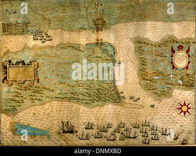 Baptista Boazio's Map of Sir Francis Drake's Raid on St. Augustine (published in 1589) Stock Photohttps://www.alamy.com/licenses-and-pricing/?v=1https://www.alamy.com/baptista-boazios-map-of-sir-francis-drakes-raid-on-st-augustine-published-image64998625.html
RMDNMXBD–Baptista Boazio's Map of Sir Francis Drake's Raid on St. Augustine (published in 1589)
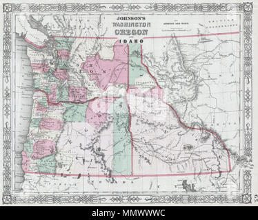 . English: This is a magnificent 1864 hand colored map depicts Washington state, Oregon and Idaho. This is a rare variant upon the same 1864 Johnson’s map issue earlier in 1864, due to the defined Idaho-Montana border. This suggests that this map was issued late in 1864 following the formation of Montana. Johnson’s Washington Oregon and Idaho.. 1864. 1864 Johnson Map of Washington, Oregon and Idaho - Geographicus - WAOR2-j-64 Stock Photohttps://www.alamy.com/licenses-and-pricing/?v=1https://www.alamy.com/english-this-is-a-magnificent-1864-hand-colored-map-depicts-washington-state-oregon-and-idaho-this-is-a-rare-variant-upon-the-same-1864-johnsons-map-issue-earlier-in-1864-due-to-the-defined-idaho-montana-border-this-suggests-that-this-map-was-issued-late-in-1864-following-the-formation-of-montana-johnsons-washington-oregon-and-idaho-1864-1864-johnson-map-of-washington-oregon-and-idaho-geographicus-waor2-j-64-image184965912.html
RMMMWWWC–. English: This is a magnificent 1864 hand colored map depicts Washington state, Oregon and Idaho. This is a rare variant upon the same 1864 Johnson’s map issue earlier in 1864, due to the defined Idaho-Montana border. This suggests that this map was issued late in 1864 following the formation of Montana. Johnson’s Washington Oregon and Idaho.. 1864. 1864 Johnson Map of Washington, Oregon and Idaho - Geographicus - WAOR2-j-64
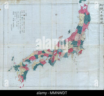 . English: This very rare item is a hand colored Meiji Period woodcut map of Japan. Impressive size and detail. Produced in the late 19th century Japanese woodcut style, this map is a rare combination of practical and decorative. All text in Japanese. A fine example from the Meiji period of Japanese cartography and an very rare piece. Meiji 4 Map of Japan.. 1871 (dated). 10 1871 (Meiji 4) Woodblock Map of Japan - Geographicus - Japan-meiji4-1871 Stock Photohttps://www.alamy.com/licenses-and-pricing/?v=1https://www.alamy.com/english-this-very-rare-item-is-a-hand-colored-meiji-period-woodcut-map-of-japan-impressive-size-and-detail-produced-in-the-late-19th-century-japanese-woodcut-style-this-map-is-a-rare-combination-of-practical-and-decorative-all-text-in-japanese-a-fine-example-from-the-meiji-period-of-japanese-cartography-and-an-very-rare-piece-meiji-4-map-of-japan-1871-dated-10-1871-meiji-4-woodblock-map-of-japan-geographicus-japan-meiji4-1871-image184877780.html
RMMMNWDT–. English: This very rare item is a hand colored Meiji Period woodcut map of Japan. Impressive size and detail. Produced in the late 19th century Japanese woodcut style, this map is a rare combination of practical and decorative. All text in Japanese. A fine example from the Meiji period of Japanese cartography and an very rare piece. Meiji 4 Map of Japan.. 1871 (dated). 10 1871 (Meiji 4) Woodblock Map of Japan - Geographicus - Japan-meiji4-1871
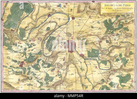 . English: A rare and beautifully hand colored c. 1780 Bonne map of Paris and its environs. Covers from Poissy in the northwest to Ferolles in the southeast, and from Chateaufort in the southwest to Gonnesse in the northeast. Depicts roads, gardens, forests, churches, and estates surrounding the city proper. Engraved by Andre as supplement no. 121 for Bonne’s Atlas. Environs de Paris.. 1780 (undated). 1780 Bonne Map of the Environs of Paris, France - Geographicus - Paris-bonne-1780 (2) Stock Photohttps://www.alamy.com/licenses-and-pricing/?v=1https://www.alamy.com/english-a-rare-and-beautifully-hand-colored-c-1780-bonne-map-of-paris-and-its-environs-covers-from-poissy-in-the-northwest-to-ferolles-in-the-southeast-and-from-chateaufort-in-the-southwest-to-gonnesse-in-the-northeast-depicts-roads-gardens-forests-churches-and-estates-surrounding-the-city-proper-engraved-by-andre-as-supplement-no-121-for-bonnes-atlas-environs-de-paris-1780-undated-1780-bonne-map-of-the-environs-of-paris-france-geographicus-paris-bonne-1780-2-image184883799.html
RMMMP54R–. English: A rare and beautifully hand colored c. 1780 Bonne map of Paris and its environs. Covers from Poissy in the northwest to Ferolles in the southeast, and from Chateaufort in the southwest to Gonnesse in the northeast. Depicts roads, gardens, forests, churches, and estates surrounding the city proper. Engraved by Andre as supplement no. 121 for Bonne’s Atlas. Environs de Paris.. 1780 (undated). 1780 Bonne Map of the Environs of Paris, France - Geographicus - Paris-bonne-1780 (2)
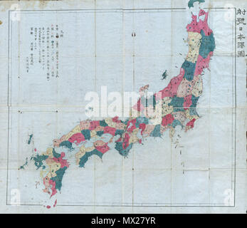 . Meiji 4 Map of Japan. English: This very rare item is a hand colored Meiji Period woodcut map of Japan. Impressive size and detail. Produced in the late 19th century Japanese woodcut style, this map is a rare combination of practical and decorative. All text in Japanese. A fine example from the Meiji period of Japanese cartography and an very rare piece. . 1871 (dated) 10 1871 (Meiji 4) Woodblock Map of Japan - Geographicus - Japan-meiji4-1871 Stock Photohttps://www.alamy.com/licenses-and-pricing/?v=1https://www.alamy.com/meiji-4-map-of-japan-english-this-very-rare-item-is-a-hand-colored-meiji-period-woodcut-map-of-japan-impressive-size-and-detail-produced-in-the-late-19th-century-japanese-woodcut-style-this-map-is-a-rare-combination-of-practical-and-decorative-all-text-in-japanese-a-fine-example-from-the-meiji-period-of-japanese-cartography-and-an-very-rare-piece-1871-dated-10-1871-meiji-4-woodblock-map-of-japan-geographicus-japan-meiji4-1871-image188134907.html
RMMX27YR–. Meiji 4 Map of Japan. English: This very rare item is a hand colored Meiji Period woodcut map of Japan. Impressive size and detail. Produced in the late 19th century Japanese woodcut style, this map is a rare combination of practical and decorative. All text in Japanese. A fine example from the Meiji period of Japanese cartography and an very rare piece. . 1871 (dated) 10 1871 (Meiji 4) Woodblock Map of Japan - Geographicus - Japan-meiji4-1871
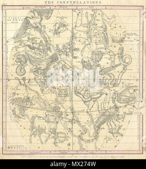 . The Constellations (July, August, September). English: This rare hand colored map of the stars was engraved W. G. Evans of New York for Burritt’s 1856 edition of the Atlas to Illustrate the Geography of the Heavens. It represents the Northern night sky in the months of July, August and September. Constellations are drawn in detail and include depictions of the Zodiacal figures the stars are said to represent. Included on this chart are Scorpio (the Scorpion), Sagittarius (the Archer), Capricorn (the Goat), Serpentarins (the Serpent Bearer) and Taurus (the Bull). Chart is quartered by lines Stock Photohttps://www.alamy.com/licenses-and-pricing/?v=1https://www.alamy.com/the-constellations-july-august-september-english-this-rare-hand-colored-map-of-the-stars-was-engraved-w-g-evans-of-new-york-for-burritts-1856-edition-of-the-atlas-to-illustrate-the-geography-of-the-heavens-it-represents-the-northern-night-sky-in-the-months-of-july-august-and-september-constellations-are-drawn-in-detail-and-include-depictions-of-the-zodiacal-figures-the-stars-are-said-to-represent-included-on-this-chart-are-scorpio-the-scorpion-sagittarius-the-archer-capricorn-the-goat-serpentarins-the-serpent-bearer-and-taurus-the-bull-chart-is-quartered-by-lines-image188134265.html
RMMX274W–. The Constellations (July, August, September). English: This rare hand colored map of the stars was engraved W. G. Evans of New York for Burritt’s 1856 edition of the Atlas to Illustrate the Geography of the Heavens. It represents the Northern night sky in the months of July, August and September. Constellations are drawn in detail and include depictions of the Zodiacal figures the stars are said to represent. Included on this chart are Scorpio (the Scorpion), Sagittarius (the Archer), Capricorn (the Goat), Serpentarins (the Serpent Bearer) and Taurus (the Bull). Chart is quartered by lines
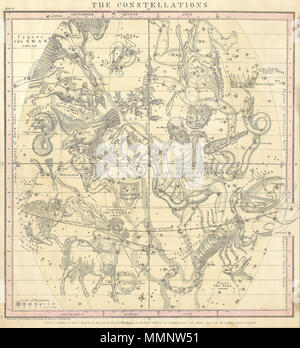 . English: This rare hand colored map of the stars was engraved W. G. Evans of New York for Burritt’s 1856 edition of the Atlas to Illustrate the Geography of the Heavens. It represents the Northern night sky in the months of July, August and September. Constellations are drawn in detail and include depictions of the Zodiacal figures the stars are said to represent. Included on this chart are Scorpio (the Scorpion), Sagittarius (the Archer), Capricorn (the Goat), Serpentarins (the Serpent Bearer) and Taurus (the Bull). Chart is quartered by lines indicating the Solstitial and Equinoctial Colu Stock Photohttps://www.alamy.com/licenses-and-pricing/?v=1https://www.alamy.com/english-this-rare-hand-colored-map-of-the-stars-was-engraved-w-g-evans-of-new-york-for-burritts-1856-edition-of-the-atlas-to-illustrate-the-geography-of-the-heavens-it-represents-the-northern-night-sky-in-the-months-of-july-august-and-september-constellations-are-drawn-in-detail-and-include-depictions-of-the-zodiacal-figures-the-stars-are-said-to-represent-included-on-this-chart-are-scorpio-the-scorpion-sagittarius-the-archer-capricorn-the-goat-serpentarins-the-serpent-bearer-and-taurus-the-bull-chart-is-quartered-by-lines-indicating-the-solstitial-and-equinoctial-colu-image184877533.html
RMMMNW51–. English: This rare hand colored map of the stars was engraved W. G. Evans of New York for Burritt’s 1856 edition of the Atlas to Illustrate the Geography of the Heavens. It represents the Northern night sky in the months of July, August and September. Constellations are drawn in detail and include depictions of the Zodiacal figures the stars are said to represent. Included on this chart are Scorpio (the Scorpion), Sagittarius (the Archer), Capricorn (the Goat), Serpentarins (the Serpent Bearer) and Taurus (the Bull). Chart is quartered by lines indicating the Solstitial and Equinoctial Colu
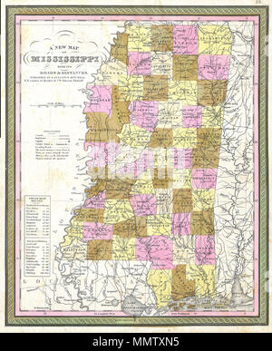 . English: This hand colored map is a copper plate engraving, dating to 1849 by the legendary American Mapmaker S.A. Mitchell, the elder. It represents Mississippi. This historically important map is extremely rare as it existed only in the 1849 edition of the Mitchell’s Universal Atlas. This map also contains notes on steamboat routes to New Orleans and to Pittsburg. A New Map of Mississippi with its Roads & Distances. 1849. 1849 Cowperthwait - Mitchell Map of Mississippi - Geographicus - MS-m-49 Stock Photohttps://www.alamy.com/licenses-and-pricing/?v=1https://www.alamy.com/english-this-hand-colored-map-is-a-copper-plate-engraving-dating-to-1849-by-the-legendary-american-mapmaker-sa-mitchell-the-elder-it-represents-mississippi-this-historically-important-map-is-extremely-rare-as-it-existed-only-in-the-1849-edition-of-the-mitchells-universal-atlas-this-map-also-contains-notes-on-steamboat-routes-to-new-orleans-and-to-pittsburg-a-new-map-of-mississippi-with-its-roads-distances-1849-1849-cowperthwait-mitchell-map-of-mississippi-geographicus-ms-m-49-image184944625.html
RMMMTXN5–. English: This hand colored map is a copper plate engraving, dating to 1849 by the legendary American Mapmaker S.A. Mitchell, the elder. It represents Mississippi. This historically important map is extremely rare as it existed only in the 1849 edition of the Mitchell’s Universal Atlas. This map also contains notes on steamboat routes to New Orleans and to Pittsburg. A New Map of Mississippi with its Roads & Distances. 1849. 1849 Cowperthwait - Mitchell Map of Mississippi - Geographicus - MS-m-49
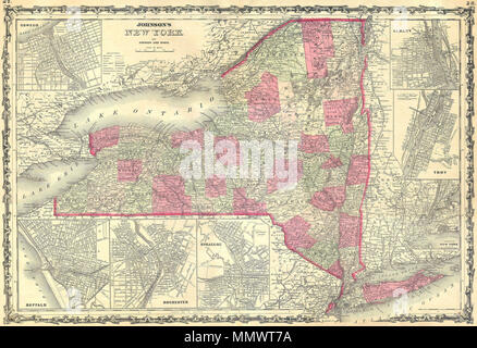 . English: This hand colored map is a steel plate engraving, dating to 1862 by the legendary American mapmaker A. J. Johnson. It depicts the state of New York. There are inset maps of Buffalo, Rochester, Syracuse, Oswego, Albany, Troy, and of course, New York City. This map is exceptionally rare as it come from the 1862 edition of Johnson’s Atlas – one of the first and rarest. Johnson's Map of New York State.. 1862. 1862 Johnson's Map of New York State - Geographicus - NY-j-62 Stock Photohttps://www.alamy.com/licenses-and-pricing/?v=1https://www.alamy.com/english-this-hand-colored-map-is-a-steel-plate-engraving-dating-to-1862-by-the-legendary-american-mapmaker-a-j-johnson-it-depicts-the-state-of-new-york-there-are-inset-maps-of-buffalo-rochester-syracuse-oswego-albany-troy-and-of-course-new-york-city-this-map-is-exceptionally-rare-as-it-come-from-the-1862-edition-of-johnsons-atlas-one-of-the-first-and-rarest-johnsons-map-of-new-york-state-1862-1862-johnsons-map-of-new-york-state-geographicus-ny-j-62-image184964622.html
RMMMWT7A–. English: This hand colored map is a steel plate engraving, dating to 1862 by the legendary American mapmaker A. J. Johnson. It depicts the state of New York. There are inset maps of Buffalo, Rochester, Syracuse, Oswego, Albany, Troy, and of course, New York City. This map is exceptionally rare as it come from the 1862 edition of Johnson’s Atlas – one of the first and rarest. Johnson's Map of New York State.. 1862. 1862 Johnson's Map of New York State - Geographicus - NY-j-62
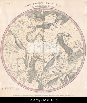 . The Constellations for Each Month in the Year. English: This rare hand colored map of the stars of the southern hemisphere was engraved W. G. Evans of New York for Burritt’s 1856 edition of the Atlas to Illustrate the Geography of the Heavens. It represents the night sky and constellations of the Southern Hemisphere. Constellations are drawn in detail and include depictions of the Zodiacal figures the stars are said to represent. Included on this chart are Hydra (the Snake), Dorado (the Sword Fish), Pavo (the Peacock) and the Centaur. Chart is quartered by lines indicating the Solstitial an Stock Photohttps://www.alamy.com/licenses-and-pricing/?v=1https://www.alamy.com/the-constellations-for-each-month-in-the-year-english-this-rare-hand-colored-map-of-the-stars-of-the-southern-hemisphere-was-engraved-w-g-evans-of-new-york-for-burritts-1856-edition-of-the-atlas-to-illustrate-the-geography-of-the-heavens-it-represents-the-night-sky-and-constellations-of-the-southern-hemisphere-constellations-are-drawn-in-detail-and-include-depictions-of-the-zodiacal-figures-the-stars-are-said-to-represent-included-on-this-chart-are-hydra-the-snake-dorado-the-sword-fish-pavo-the-peacock-and-the-centaur-chart-is-quartered-by-lines-indicating-the-solstitial-an-image188897991.html
RMMY918R–. The Constellations for Each Month in the Year. English: This rare hand colored map of the stars of the southern hemisphere was engraved W. G. Evans of New York for Burritt’s 1856 edition of the Atlas to Illustrate the Geography of the Heavens. It represents the night sky and constellations of the Southern Hemisphere. Constellations are drawn in detail and include depictions of the Zodiacal figures the stars are said to represent. Included on this chart are Hydra (the Snake), Dorado (the Sword Fish), Pavo (the Peacock) and the Centaur. Chart is quartered by lines indicating the Solstitial an
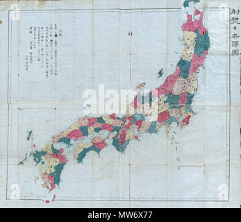 . Meiji 4 Map of Japan. English: This very rare item is a hand colored Meiji Period woodcut map of Japan. Impressive size and detail. Produced in the late 19th century Japanese woodcut style, this map is a rare combination of practical and decorative. All text in Japanese. A fine example from the Meiji period of Japanese cartography and an very rare piece. . 1871 (dated) 9 1871 (Meiji 4) Woodblock Map of Japan - Geographicus - Japan-meiji4-1871 Stock Photohttps://www.alamy.com/licenses-and-pricing/?v=1https://www.alamy.com/meiji-4-map-of-japan-english-this-very-rare-item-is-a-hand-colored-meiji-period-woodcut-map-of-japan-impressive-size-and-detail-produced-in-the-late-19th-century-japanese-woodcut-style-this-map-is-a-rare-combination-of-practical-and-decorative-all-text-in-japanese-a-fine-example-from-the-meiji-period-of-japanese-cartography-and-an-very-rare-piece-1871-dated-9-1871-meiji-4-woodblock-map-of-japan-geographicus-japan-meiji4-1871-image187622379.html
RMMW6X77–. Meiji 4 Map of Japan. English: This very rare item is a hand colored Meiji Period woodcut map of Japan. Impressive size and detail. Produced in the late 19th century Japanese woodcut style, this map is a rare combination of practical and decorative. All text in Japanese. A fine example from the Meiji period of Japanese cartography and an very rare piece. . 1871 (dated) 9 1871 (Meiji 4) Woodblock Map of Japan - Geographicus - Japan-meiji4-1871
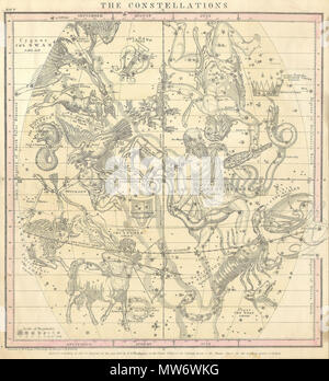 . The Constellations (July, August, September). English: This rare hand colored map of the stars was engraved W. G. Evans of New York for Burritt’s 1856 edition of the Atlas to Illustrate the Geography of the Heavens. It represents the Northern night sky in the months of July, August and September. Constellations are drawn in detail and include depictions of the Zodiacal figures the stars are said to represent. Included on this chart are Scorpio (the Scorpion), Sagittarius (the Archer), Capricorn (the Goat), Serpentarins (the Serpent Bearer) and Taurus (the Bull). Chart is quartered by lines Stock Photohttps://www.alamy.com/licenses-and-pricing/?v=1https://www.alamy.com/the-constellations-july-august-september-english-this-rare-hand-colored-map-of-the-stars-was-engraved-w-g-evans-of-new-york-for-burritts-1856-edition-of-the-atlas-to-illustrate-the-geography-of-the-heavens-it-represents-the-northern-night-sky-in-the-months-of-july-august-and-september-constellations-are-drawn-in-detail-and-include-depictions-of-the-zodiacal-figures-the-stars-are-said-to-represent-included-on-this-chart-are-scorpio-the-scorpion-sagittarius-the-archer-capricorn-the-goat-serpentarins-the-serpent-bearer-and-taurus-the-bull-chart-is-quartered-by-lines-image187621940.html
RMMW6WKG–. The Constellations (July, August, September). English: This rare hand colored map of the stars was engraved W. G. Evans of New York for Burritt’s 1856 edition of the Atlas to Illustrate the Geography of the Heavens. It represents the Northern night sky in the months of July, August and September. Constellations are drawn in detail and include depictions of the Zodiacal figures the stars are said to represent. Included on this chart are Scorpio (the Scorpion), Sagittarius (the Archer), Capricorn (the Goat), Serpentarins (the Serpent Bearer) and Taurus (the Bull). Chart is quartered by lines