3010 x 4226 px | 25,5 x 35,8 cm | 10 x 14,1 inches | 300dpi
Fecha de toma:
1849
Ubicación:
South & Central America
Más información:
Esta imagen podría tener desperfectos porque se trata de una imagen histórica o de reportaje.
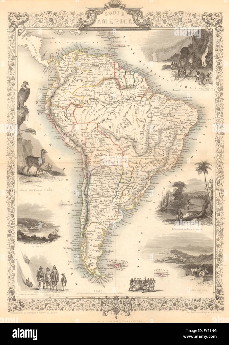
'South America'. Artist/engraver/cartographer: Map drawn and engraved by J. Rapkin; vignette illustrations drawn by J Marchant & engraved by J Rogers. Published by John Tallis & Co. Provenance: "The British Colonies' their history, extent, condition and resources", by Montgomery Martin Esq. Published by John Tallis & Company, London & New York. Type: Antique engraved map by J Rapkin, published by John Tallis. Original outline hand colour, decorative border, and attractive inset vignette views. This fascinating map shows Peru & Bolivia unified as the short-lived Peru–Bolivian Confederation, although this had ceased to exist in 1839. It also shows a united Gran Colombia, incorporating New Granada (today Colombia & Panama), Venezuela & Ecuador; however Gran Colombia had ceased to exist in 1831, when Ecuador & Venezuela had seceded. Uruguay is named as "Banda Oriental", Patagonia is shown as a separate state, with the balance of today's Argentina marked with its earlier name of "La Plata". Vignettes: Gold Washing in Brazil; Condor and Llamas in Peru; Brazilian Bridge of Ropes; Valparaiso; Descent of the Cordilleras; Natives of Chile; Rio de Janeiro
Ahorre hasta un 70 % con nuestros paquetes de imágenes
Pague por adelantado varias imágenes y descárguelas cuando las necesite.