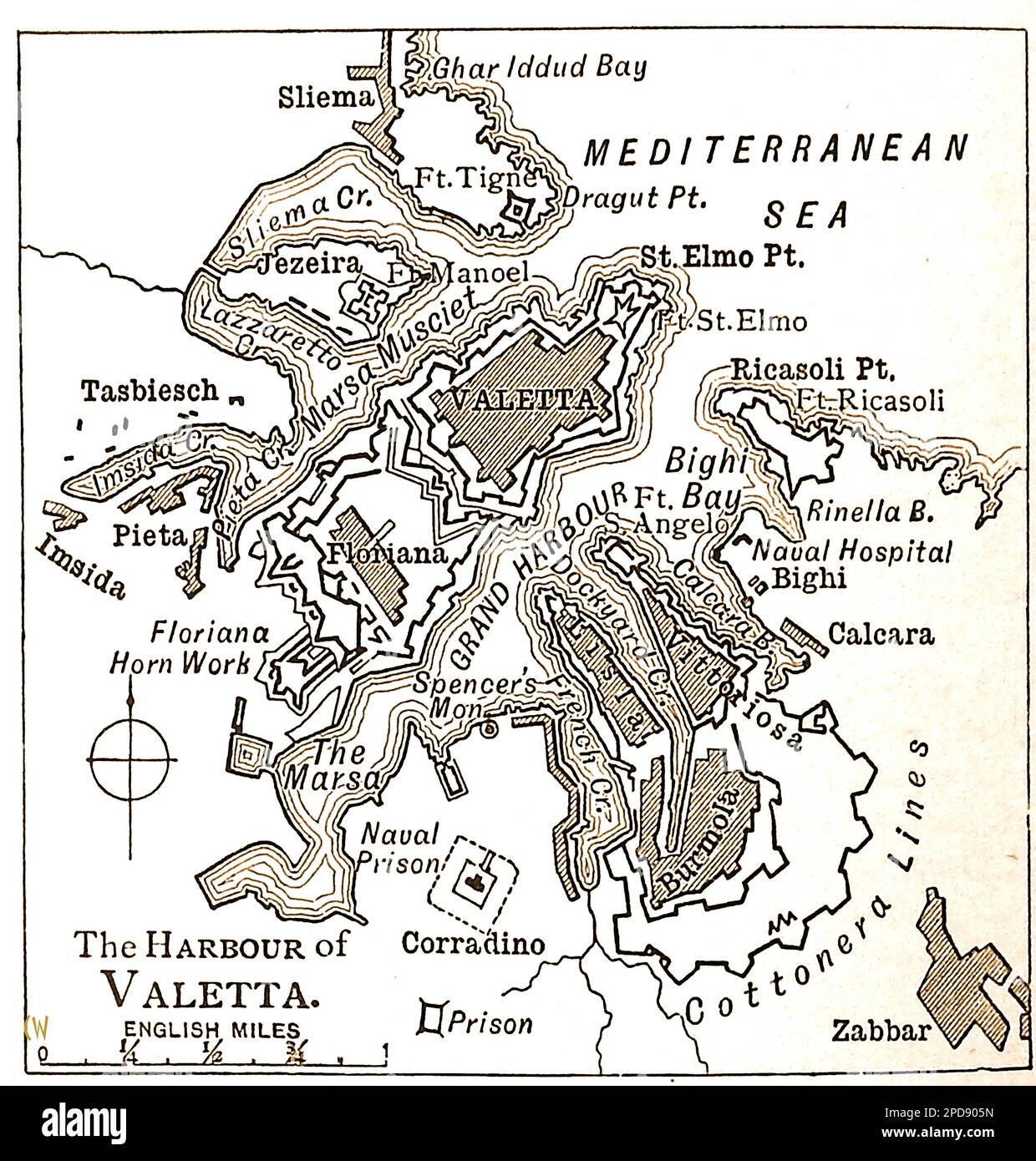
A 19th century map of Valetta (Malta) Harbour and environs. --- Mappa tas-seklu 19 tal-Port ta' Valetta (Malta) u l-environs. ---
RMID:Image ID:2PD905N
Image details
Contributor:
Colin Waters / Alamy Stock PhotoImage ID:
2PD905NFile size:
95.2 MB (3 MB Compressed download)Releases:
Model - no | Property - noDo I need a release?Dimensions:
5637 x 5906 px | 47.7 x 50 cm | 18.8 x 19.7 inches | 300dpiDate taken:
24 January 2023More information:
This image could have imperfections as it’s either historical or reportage.