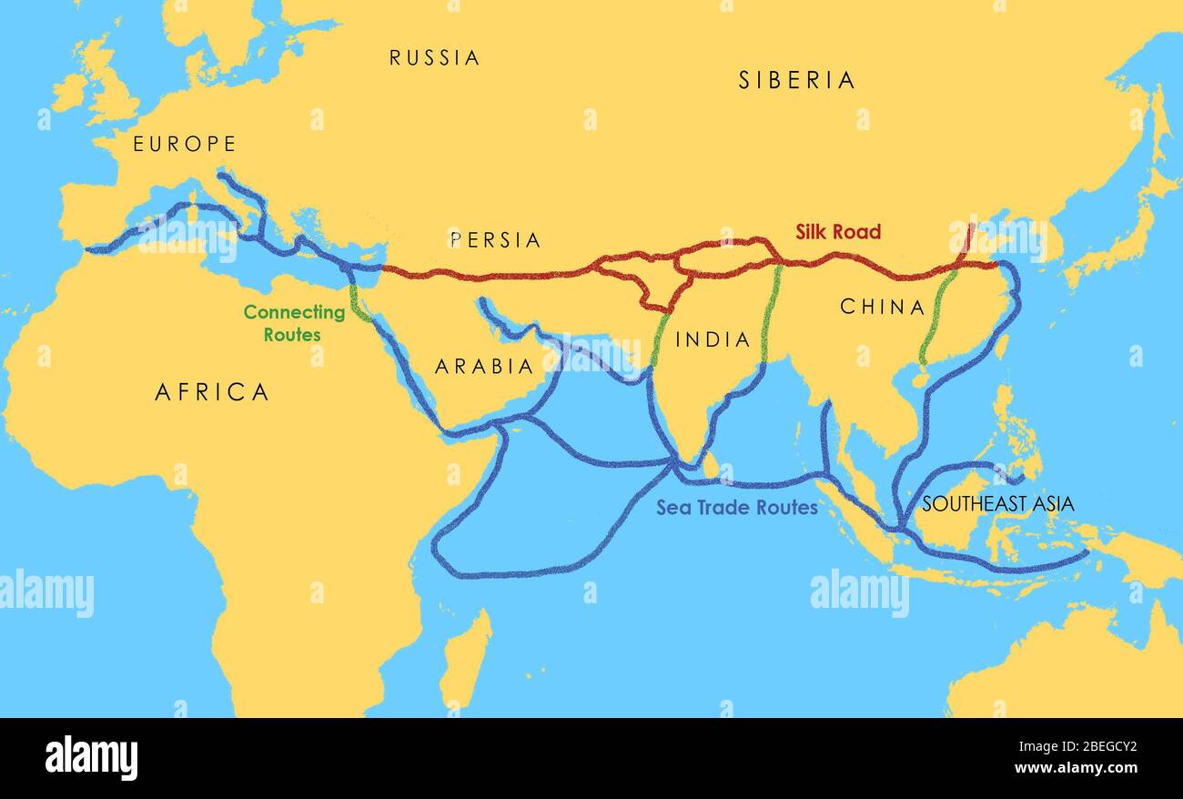
A map showing a network of medieval trade routes, including the Silk Road (connecting East and West between the 2nd century BCE and the 18th century) and various sea trade routes.
RMID:Image ID:2BEGCY2
Image details
Contributor:
Science History Images / Alamy Stock PhotoImage ID:
2BEGCY2File size:
14.3 MB (304.3 KB Compressed download)Releases:
Model - no | Property - noDo I need a release?Dimensions:
2868 x 1740 px | 24.3 x 14.7 cm | 9.6 x 5.8 inches | 300dpiDate taken:
14 August 2002Photographer:
Photo ResearchersMore information:
This image could have imperfections as it’s either historical or reportage.