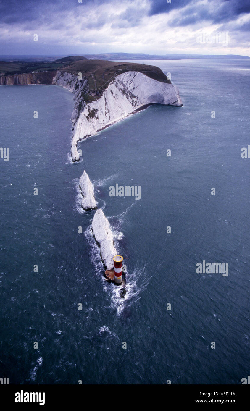
Aerial The Needles Isle of Wight England Great Britain uk
Image details
Contributor:
Patrick Eden / Alamy Stock PhotoImage ID:
A6F11AFile size:
32.6 MB (1.5 MB Compressed download)Releases:
Model - no | Property - noDo I need a release?Dimensions:
2720 x 4183 px | 23 x 35.4 cm | 9.1 x 13.9 inches | 300dpiMore information:
Set in the western approaches to the Isle of Wight, the Needles form a narrow chalky peninsula which rises from jagged rocks to 120m cliffs. These rocks have always been a hazard to ships making their way up the Solent to Portsmouth and Southampton Water. In 1781 merchants and shipowners petitioned Trinity House for a lighthouse. They obtained a patent in January 1782 which directed that lights should be: kept burning in the nightseason whereby seafaring men and mariners might take notice and avoid danger..... and ships and other vessels of war might safely cruise during the night season in the British Channel. Negotiations must have failed because it was not until 1785 that Trinity House erected to the designs of R. Jupp, for 30 years surveyor to the East India Company, three lighthouses at the Needles, St. Catherine's Point and Hurst Point. The Needles tower was lighted on the 29th September 1786. As the tower was situated on top of a cliff overhanging Scratchell's Bay, the light which was 144m above sea level was often obscured by sea mists and fogs and was therefore of limited use to mariners. In 1859 Trinity House planned a new lighthouse to be built on the outermost of the chalk rocks near sea level. It was designed by James Walker and cost £20, 000. The circular granite tower has perpendicular sides and is 33.25m high, of uniform diameter with an unevenly stepped base to break the waves and discourage sea sweeping up the tower. The wall varies from 1.07m in thickness at the entrance to 0.61m at the top. Much of the base rock was cut away to form the foundation, and cellars and storehouses were excavated in the chalk. The light at the Needles has two white, two red and one green sector, with one of the red sectors intensified, these are set out as follows: Red intensified sector shore to 300 marks the St Anthony Rocks White sector 300 to 083 marks the approach to the Needles Channel from the west Red sector 083 to 212 marks the Shingles Bank White sector 2