Africa and its inhabitants . roonsand the Congo is intersected by a large number of closely ramifying streams. THE GABOON ESTUARY. 887 The Etembwe, or Rio del Campo, southern limit of the German possessions, isfollowed by the Eyo, or San-Benito, which rcai-hes the coast 36 miles north ofCape St. John, and which is navigable for 20 mik>.s to the Yobe falls. The Muni(Angra, or Danger), which enters Corisco Bay opposite the Elobey Islands, is alsoobstructed by formidable cataracts during its passage through the red sandstoneescarpments of the coast ranges. South of the Muni the narrow island-s
Image details
Contributor:
The Reading Room / Alamy Stock PhotoImage ID:
2AJ8AK4File size:
7.1 MB (309.9 KB Compressed download)Releases:
Model - no | Property - noDo I need a release?Dimensions:
2126 x 1175 px | 36 x 19.9 cm | 14.2 x 7.8 inches | 150dpiMore information:
This image is a public domain image, which means either that copyright has expired in the image or the copyright holder has waived their copyright. Alamy charges you a fee for access to the high resolution copy of the image.
This image could have imperfections as it’s either historical or reportage.
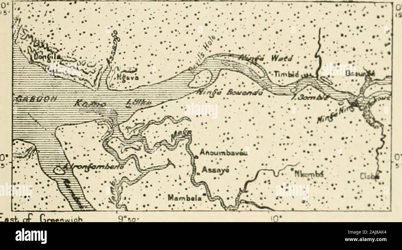
Africa and its inhabitants . roonsand the Congo is intersected by a large number of closely ramifying streams. THE GABOON ESTUARY. 887 The Etembwe, or Rio del Campo, southern limit of the German possessions, isfollowed by the Eyo, or San-Benito, which rcai-hes the coast 36 miles north ofCape St. John, and which is navigable for 20 mik>.s to the Yobe falls. The Muni(Angra, or Danger), which enters Corisco Bay opposite the Elobey Islands, is alsoobstructed by formidable cataracts during its passage through the red sandstoneescarpments of the coast ranges. South of the Muni the narrow island-studded inlet bounded on the west by theCape Esteiras peninsula has received the name of Rio Munda, as if it were a river, being in reality a mere estuary into M-liich are discharged a few feeble coast-streams. The same description applies to the Gaboon itself, which also receivedthe name of riu from the early navigators, and which till within the last few Fiof. 18G.—Confluence op the Komo ant> Raxbok. Scale : : 45lJ, 000.. Last of Groenwiot 9°5o- Depths. otoie Fwt. in Ff>et andiipwurdi*. decades was still regarded as one of the great continental rivers, whose Bourcpswere souo-ht in the areat lakes of the interior. But the Gaboon, so called by thePortuguese from its fancied resemblancp to a gubuo, or cabin. penetratesinland little more than 40 miles. In its general .lutlines. size, and hydrographicsystem it recalls in a striking way the Frcncli estuary of the Gironde. althoughsomewhat broader and with a greater average depth. Like that of the Gironde, the entrance is obstructed with sandbanks, which have had to be carefully buoyed, marking off four deep channels with :2t; to -Jy feet of water nt ebb fide. In ifaupper reaches the estuary is accessible to vessels drawing I-5 or 14 feet, and it.-, twcv affluents, the Komo and Ramboe, as well as several of their tributorie*. are 888 WEST APEICA. also navigable by small craft. Of the two the Komo is the larger, rising like theMun