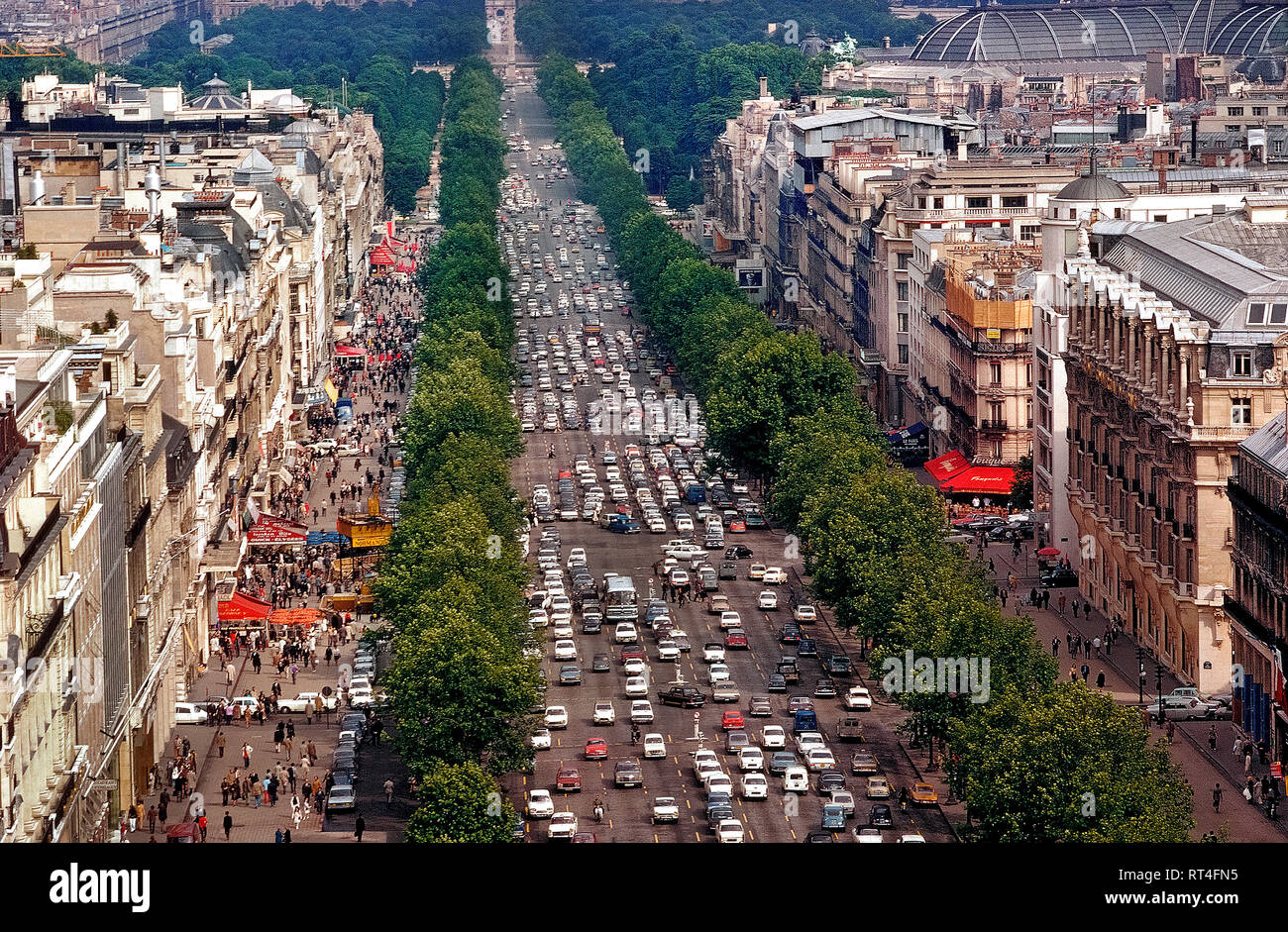
An aerial view shows the beautiful tree-lined Champs-Élysées, one of the busiest and most congested avenues in all of Paris, France. The famous 1.2 mile-long (1.9 km) thoroughfare runs between two of the French capital's monumental landmarks, the Place de la Concorde and Arc de Triomphe. Since this photograph was taken in 1983, the 11 lanes of traffic have been reduced to eight and there are plans to reduce vehicle use even more in order widen the sidewalks and make the street more pedestrian friendly by the mid-2020s.
RMID:Image ID:RT4FN5
Image details
Contributor:
Michele and Tom Grimm / Alamy Stock PhotoImage ID:
RT4FN5File size:
27.3 MB (3.6 MB Compressed download)Releases:
Model - no | Property - noDo I need a release?Dimensions:
3817 x 2500 px | 32.3 x 21.2 cm | 12.7 x 8.3 inches | 300dpiDate taken:
1983Location:
Champs-Élysées, Paris, FranceMore information:
This image could have imperfections as it’s either historical or reportage.
An aerial view shows the beautiful tree-lined Champs-Élysées, one of the busiest and most congested avenues in all of Paris, France. The famous 1.2 mile-long (1.9 km) thoroughfare runs between two of the French capital's monumental landmarks, the Place de la Concorde and Arc de Triomphe. Since this photograph was taken in 1983, the 11 lanes of traffic have been reduced to eight and there are plans to reduce vehicle use even more in order widen the sidewalks and make the street more pedestrian friendly by the mid-2020s.