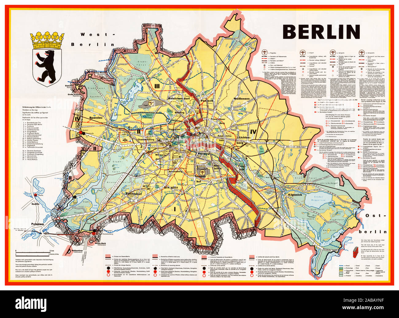
BERLIN WALL Vintage 1960’s Berlin Cold War Propaganda map illustration showing the Berlin Wall as a bricked-up barrier and barbed wire surrounding West Berlin. Airports, government buildings, factories and other sites are shown in the West, but none in the East. Detailed explanations of transportation, borders and border crossing are provided in German, English, French and Spanish - but not in Russian. The map was published by the Press and Information Office of the State of Berlin, in 1963. Germany
Image details
Contributor:
Shawshots / Alamy Stock PhotoImage ID:
2ABAYNFFile size:
92 MB (8.7 MB Compressed download)Releases:
Model - no | Property - noDo I need a release?Dimensions:
6650 x 4835 px | 56.3 x 40.9 cm | 22.2 x 16.1 inches | 300dpiDate taken:
1963Location:
Berlin GermanyMore information:
This image could have imperfections as it’s either historical or reportage.
Vintage 1960’s Berlin cold war map showing the Berlin Wall as a bricked-up barrier and barbed wire surrounding West Berlin. Airports, government buildings, factories and other sites are shown in the West, but none in the East. Detailed explanations of transportation, borders and border crossing are provided in German, English, French and Spanish - but not in Russian. The map was published by the Press and Information Office of the State of Berlin, probably in 1963. Among other uses, these maps were distributed by the United States Air Force Representative Berlin as part of the Air Force's 7350th Support Group "Tempelhof Central Airport Visitor's Kit, " called "Welcome to BERLIN."