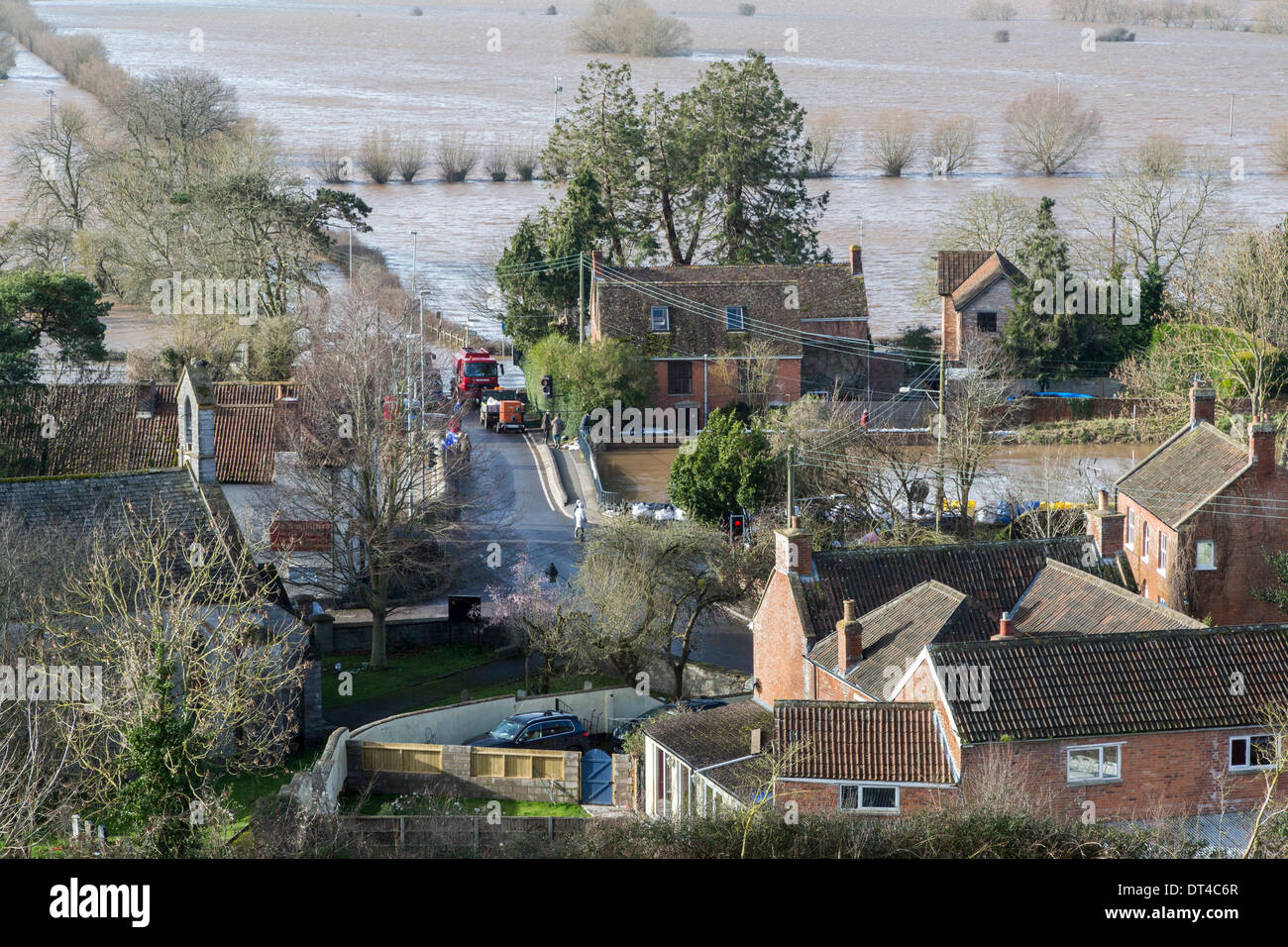
Borrowbridge, Somerset, UK. 8th February 2014. The village of Burrowbridge in Somerset on 8th February 2014 surrounded by floodwater as viewed from the top of Burrow Mump. Due to exceptionally high rainfall, the River Parrett has been unable to cope with the volume of water and has flooded nearby farmland and the main road the A361 to Taunton has been closed for seven weeks. A severe flood alert which means life may be at risk remains in place and many occupants have been told to evacuate. Credit: Nick Cable/Alamy Live News
RMID:Image ID:DT4C6R
Image details
Contributor:
Nick Cable / Alamy Stock PhotoImage ID:
DT4C6RFile size:
60.7 MB (4.7 MB Compressed download)Releases:
Model - no | Property - noDo I need a release?Dimensions:
5643 x 3762 px | 47.8 x 31.9 cm | 18.8 x 12.5 inches | 300dpiDate taken:
8 February 2014Location:
A361, Burrowbridge, Somerset, England, UKMore information:
This image could have imperfections as it’s either historical or reportage.