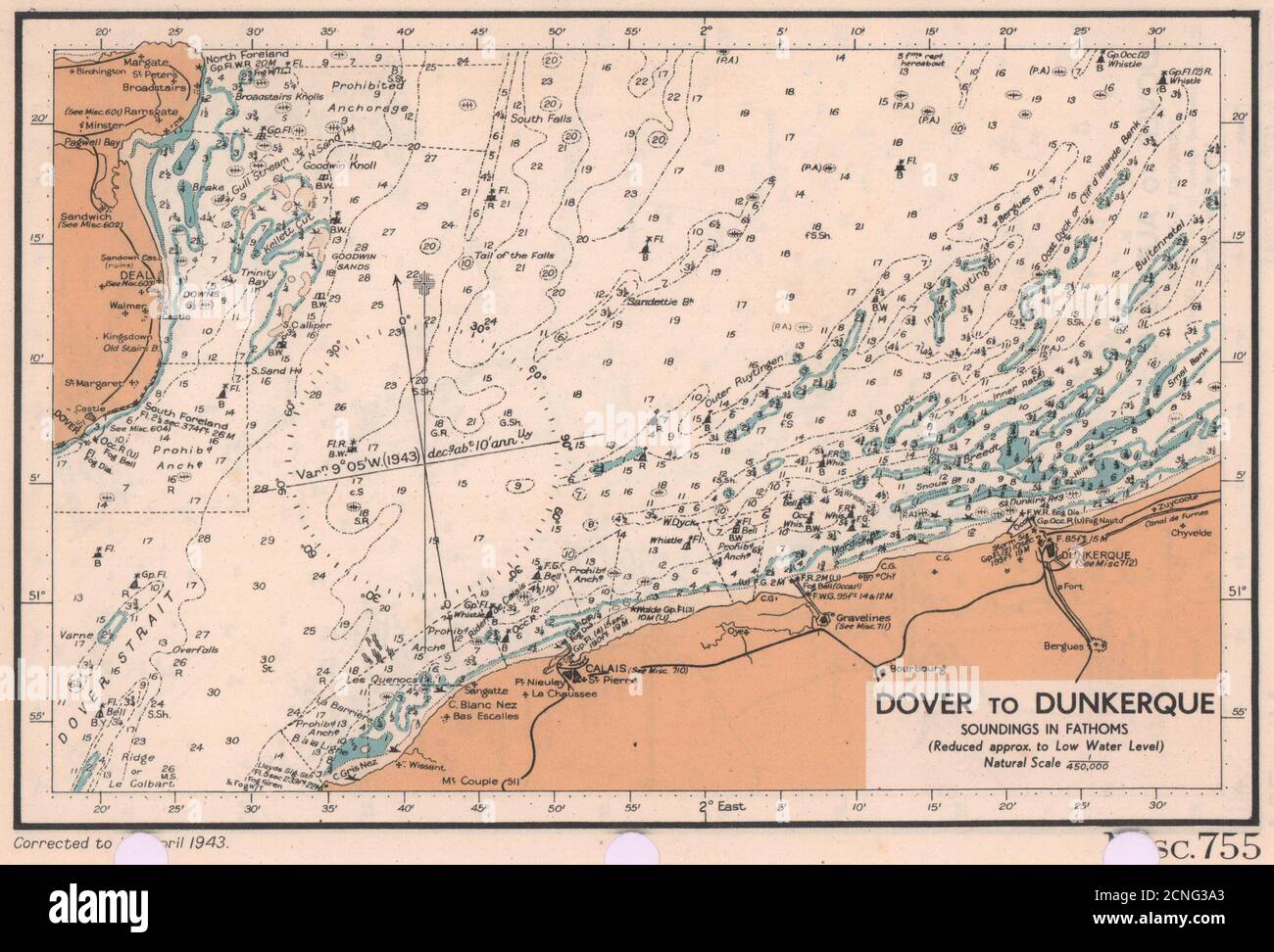
Dover to Dunkirk sea coast chart. D-Day planning map. ADMIRALTY 1943 old
RFID:Image ID:2CNG3A3
Image details
Contributor:
Antiqua Print Gallery / Alamy Stock PhotoImage ID:
2CNG3A3File size:
13.6 MB (748.8 KB Compressed download)Releases:
Model - no | Property - noDo I need a release?Dimensions:
2644 x 1795 px | 22.4 x 15.2 cm | 8.8 x 6 inches | 300dpiDate taken:
1943Location:
Pas-de-CalaisMore information:
This image could have imperfections as it’s either historical or reportage.
Dover to Dunkerque. Soundings in fathoms (reduced approx. to low water level) natural scale 1/450, 000. Artist/engraver/cartographer: The British Admiralty. Provenance: "English Channel Handbook": 1st Edition; Published by The Hydrographic Department of the Admiralty. Type: Vintage colour sea chart.