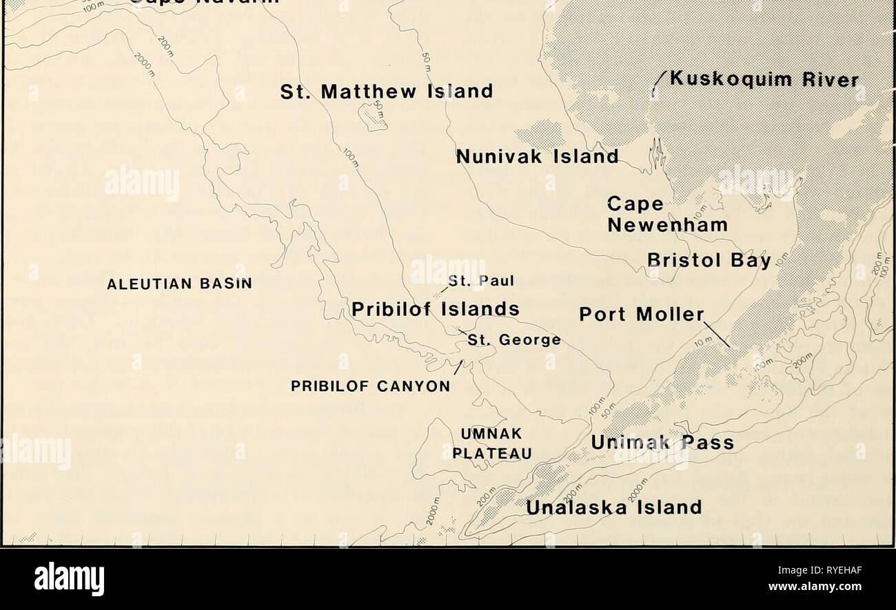
The Eastern Bering Sea Shelf : oceanography and resources / edited by Donald W. Hood and John A. Calder easternberings00hood Year: 1981 170° 175' 180° 175° 170° 165° 160° 155 150° I ^, [^ I—' Chkchi Sea 65' 62' 59° 56° 53° 100 200 krr 50 0 50 100 miles ^ IGulf, of Anady iC phukotsk Peninsula ^( « ^ ,^ J |( Seward ^<^ J^medB Peninsula '-^'^m Islands Norton Sound n^::Xape St. Lawrence Island ' ^ukon River Navarin ^--* /Kuskoqulm River 65 62' 59'^ 56' 53'' 180 175' 170° 165' 160 Figure 1. The eastern Bering Sea shelf. bring on the spring melt. On the other hand, 1977-79 was a period of hi
Image details
Contributor:
Bookend / Alamy Stock PhotoImage ID:
RYEHAFFile size:
5.7 MB (232.4 KB Compressed download)Releases:
Model - no | Property - noDo I need a release?Dimensions:
1806 x 1107 px | 30.6 x 18.7 cm | 12 x 7.4 inches | 150dpiMore information:
This image is a public domain image, which means either that copyright has expired in the image or the copyright holder has waived their copyright. Alamy charges you a fee for access to the high resolution copy of the image.
This image could have imperfections as it’s either historical or reportage.
The Eastern Bering Sea Shelf : oceanography and resources / edited by Donald W. Hood and John A. Calder easternberings00hood Year: 1981 170° 175' 180° 175° 170° 165° 160° 155 150° I ^, [^ I—' Chkchi Sea 65' 62' 59° 56° 53° 100 200 krr 50 0 50 100 miles ^ IGulf, of Anady iC phukotsk Peninsula ^( « ^ , ^ J |( Seward ^<^ J^medB Peninsula '-^'^m Islands Norton Sound n^::Xape St. Lawrence Island ' ^ukon River Navarin ^--* /Kuskoqulm River 65 62' 59'^ 56' 53'' 180 175' 170° 165' 160 Figure 1. The eastern Bering Sea shelf. bring on the spring melt. On the other hand, 1977-79 was a period of high air and sea temperatures and limited ice coverage brought on by southerly shifting winds (See Niebauer, Chapter 9, this volume). These widely varying physical conditions greatly influenced the primary productivity, and thereby all other biotic components, of the shelf region, as described in Sections VII and X of Volume 2. The oceanographic significance of the shallow northern opening of the Bering Sea through the Bering Strait into the Chukchi Sea is yet to be fully ascertained, particularly as it contributes to the whole of the biological system. The pathway to the Arctic from the Pacific through the Bering Sea has long been known to be of major importance to some migrating whales (See Frost and Lowry, Chapter 50, Volume 2). Furthermore, the significance of the Bering Strait passage for walrus, seals, and beluga and bowhead whales between the Arctic and Bering Sea is discussed by Burns, Chapter 46 and Lowry and Frost, Chapter 49 of Volume 2. Although some of the highest short-term primary production rates XIV