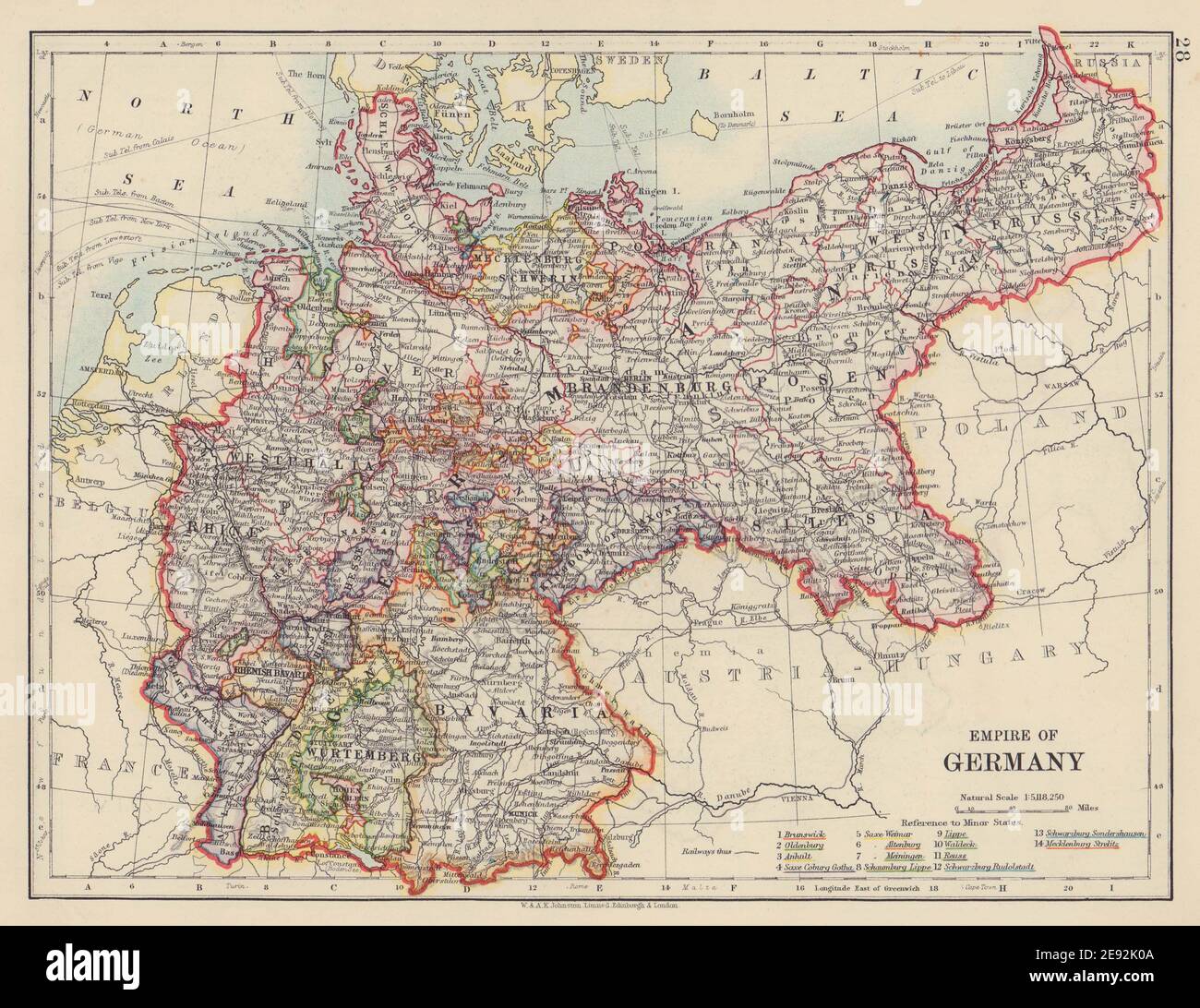
EMPIRE OF GERMANY. States. Prussia Bavaria Alsace Lorraine. JOHNSTON 1910 map
RFID:Image ID:2E92K0A
Image details
Contributor:
Antiqua Print Gallery / Alamy Stock PhotoImage ID:
2E92K0AFile size:
22.3 MB (1.2 MB Compressed download)Releases:
Model - no | Property - noDo I need a release?Dimensions:
3179 x 2452 px | 26.9 x 20.8 cm | 10.6 x 8.2 inches | 300dpiDate taken:
1910Location:
GermanyMore information:
This image could have imperfections as it’s either historical or reportage.
Empire of Germany. Artist/engraver/cartographer: W & AK Johnston . Provenance: "The World Wide Atlas of Modern Geography Political and Physical"; by J. Scott Keltie; Published by W. & A. K. Johnston, Edinburgh & London. 7th Edition (revised) [World wide atlas]. Type: Colour antique map.