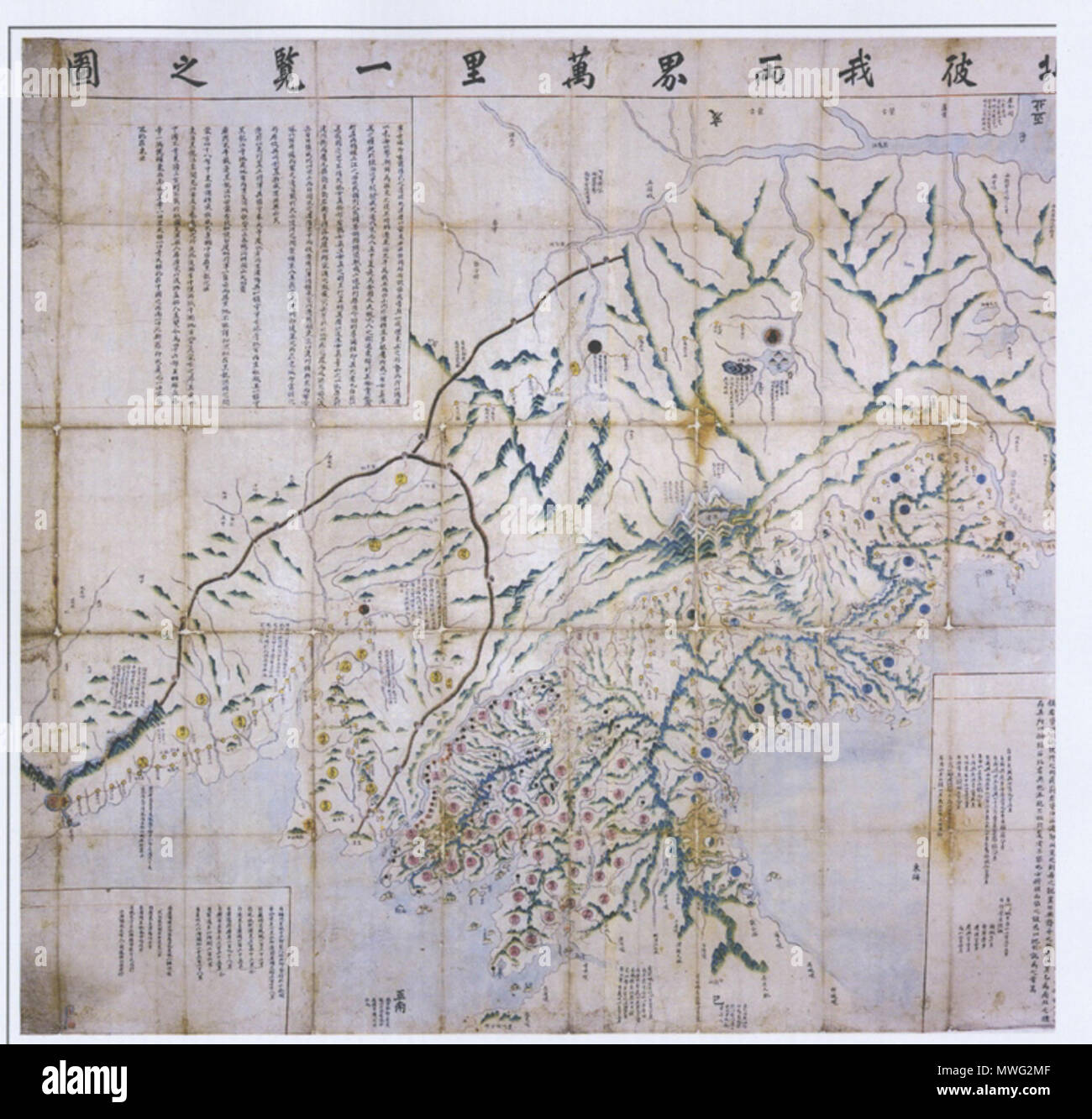
. 한국어: 서북피아양계만리일람지도. 작자, 연대 미상의 한국 관북 관서 지방과 만주 지방, 러시아의 연해주를 포함하는 관방지도 English: An Korean old map of 'Seobuk Pia Yangye Malli Ilram Jido', of which literally refers to Northern West regions of Joseon and Qing china. It includes current Manchria and Russian region of Primorsky Krai where a great deal of Koreans lived throughout Joseon period. Español: Un mapa coreano 'Seobuk Pia Yangye Malli Ilram Jido' del siglo 18. Describe la parte noroeste de la peninsula coreana y tambien Manchuria y ahorita Primorsky Krai de Rusia donde la gran populacion coreana vivieron. 2 November 2008. Anonymous (c.
Image details
Contributor:
The Picture Art Collection / Alamy Stock PhotoImage ID:
MWG2MFFile size:
14.3 MB (616.1 KB Compressed download)Releases:
Model - no | Property - noDo I need a release?Dimensions:
2286 x 2187 px | 38.7 x 37 cm | 15.2 x 14.6 inches | 150dpiMore information:
This image is a public domain image, which means either that copyright has expired in the image or the copyright holder has waived their copyright. Alamy charges you a fee for access to the high resolution copy of the image.
This image could have imperfections as it’s either historical or reportage.
. 한국어: 서북피아양계만리일람지도. 작자, 연대 미상의 한국 관북 관서 지방과 만주 지방, 러시아의 연해주를 포함하는 관방지도 English: An Korean old map of 'Seobuk Pia Yangye Malli Ilram Jido', of which literally refers to Northern West regions of Joseon and Qing china. It includes current Manchria and Russian region of Primorsky Krai where a great deal of Koreans lived throughout Joseon period. Español: Un mapa coreano 'Seobuk Pia Yangye Malli Ilram Jido' del siglo 18. Describe la parte noroeste de la peninsula coreana y tambien Manchuria y ahorita Primorsky Krai de Rusia donde la gran populacion coreana vivieron. 2 November 2008. Anonymous (c. early 18th century) 346 Korean old map Northern west regions of Korea