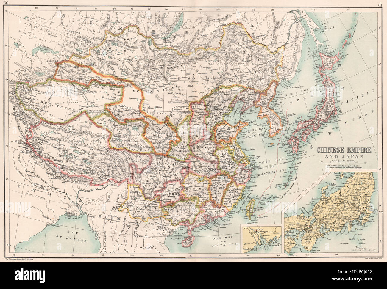
EAST ASIA: Chinese Empire China Japan Mongolia Korea; Canton Guangdong, 1891 map
RFID:Image ID:FCJ092
Image details
Contributor:
Antiqua Print Gallery / Alamy Stock PhotoImage ID:
FCJ092File size:
61.9 MB (4.9 MB Compressed download)Releases:
Model - no | Property - noDo I need a release?Dimensions:
5646 x 3832 px | 47.8 x 32.4 cm | 18.8 x 12.8 inches | 300dpiDate taken:
1891Location:
East AsiaMore information:
This image could have imperfections as it’s either historical or reportage.
Artist/engraver/cartographer: John Bartholomew . Provenance: "The English Imperial Atlas and Gazetteer of the World"; by J. G. Bartholomew, Published by T. Nelson & Sons, London. Type: Antique colour map.