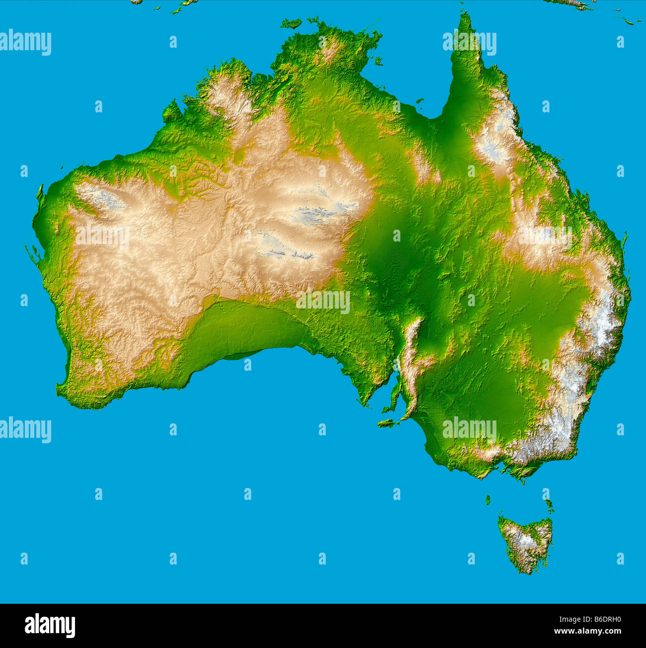
Australia. Computer-enhanced topographical image of the continent of Australia.
Image details
Contributor:
Science Photo Library / Alamy Stock PhotoImage ID:
B6DRH0File size:
72.3 MB (5.8 MB Compressed download)Releases:
Model - no | Property - noDo I need a release?Dimensions:
5200 x 4858 px | 44 x 41.1 cm | 17.3 x 16.2 inches | 300dpiPhotographer:
NASA/SPLMore information:
andlt;strongandgt;Australia.andlt;/strongandgt; Computer-enhanced topographicalimage of the continent of Australia, which coversan area of over 7.5 million square kilometres, andis the smallest and flattest of the continents. Atfar right is the Great Dividing Range (beige). TheLake Eyre Basin (dark green, centre right) is 16metres below sea level and is one of the worldandamp;apos;slargest drainage systems. The green upside-downandamp;apos;Uandamp;apos; (centre left) is the Nullarbor Plain, a low-lying limestone plateau. The island of Tasmania isat bottom right. This image was obtained bycombining shading and colour coding of topographicheight. The data were acquired on the ShuttleRadar Topographic Mission (SRTM, Space ShuttleEndeavour, February 2000).