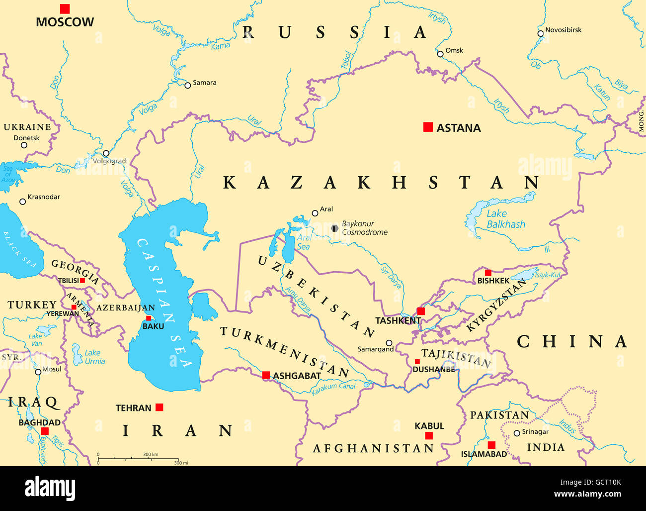
Caucasus and Central Asia political map with countries, their capitals, national borders, important cities, rivers and lakes.
RFID:Image ID:GCT10K
Image details
Contributor:
Peter Hermes Furian / Alamy Stock PhotoImage ID:
GCT10KFile size:
142.9 MB (2.7 MB Compressed download)Releases:
Model - no | Property - noDo I need a release?Dimensions:
8323 x 6000 px | 70.5 x 50.8 cm | 27.7 x 20 inches | 300dpiDate taken:
9 July 2016Location:
Caucasus