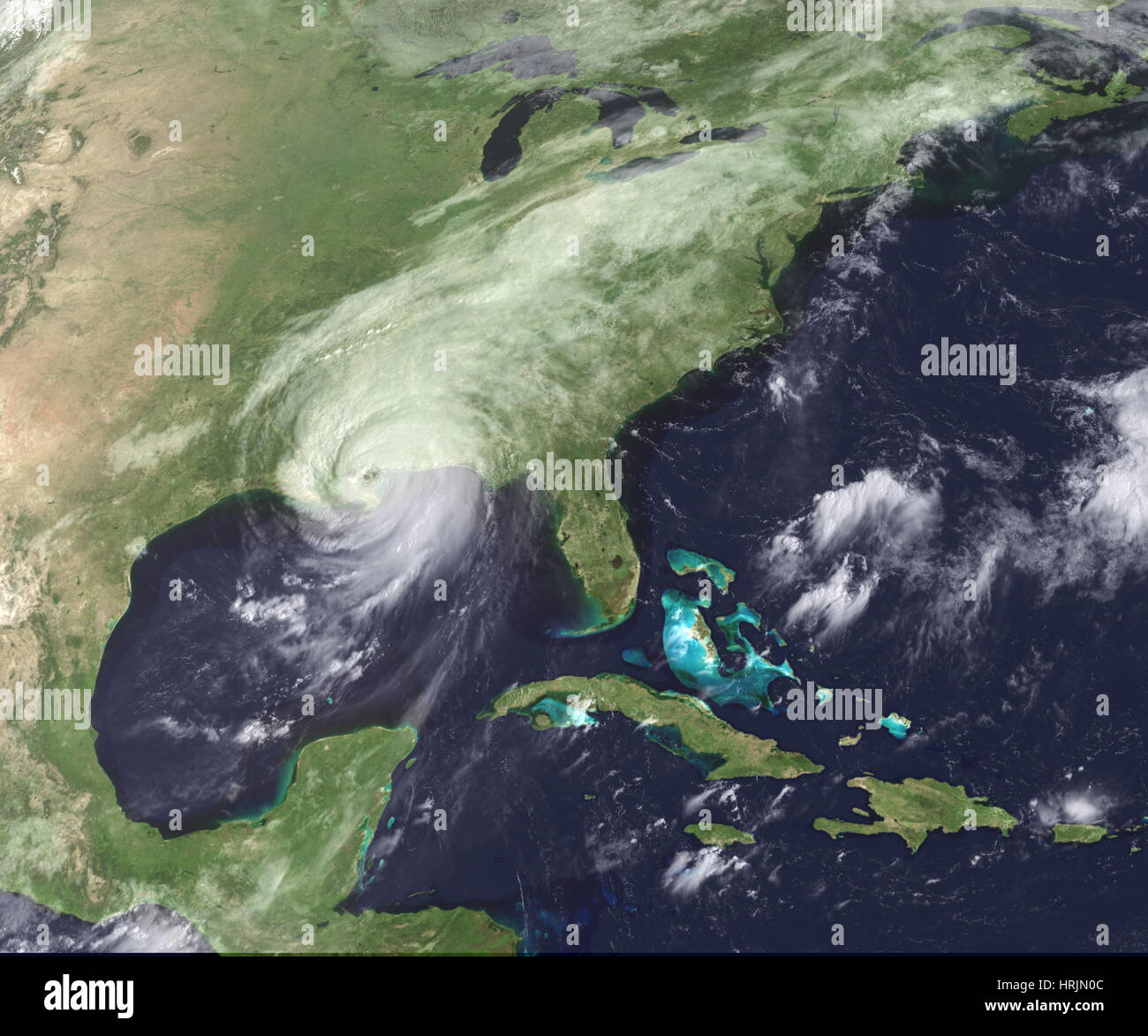
Hurricane Katrina, GOES Image, 2005
Image details
Contributor:
Science History Images / Alamy Stock PhotoImage ID:
HRJN0CFile size:
39.1 MB (1.4 MB Compressed download)Releases:
Model - no | Property - noDo I need a release?Dimensions:
4050 x 3375 px | 34.3 x 28.6 cm | 13.5 x 11.3 inches | 300dpiPhotographer:
Photo ResearchersMore information:
This image could have imperfections as it’s either historical or reportage.
Hurricane Katrina moved ashore over southeast Louisiana and southern Mississippi early on August 29, 2005, as an extremely dangerous Category 4 storm. With winds of 135 miles per hour (217 kilometers per hour), a powerful storm surge, and heavy rains, Katrina pounded the U.S. Gulf Coast, triggering extensive life-threatening flooding. This GOES image shows the storm as it moved over southern Mississippi at 9:02 a.m. The eye of the storm was due east of New Orleans, Louisiana. Katrina moved north into Mississippi, and was expected to track quickly northeast across the United States into Eastern Canada over the first part of the week. By mid-afternoon on August 29, Katrina had weakened into a Category 1 hurricane with winds of 95 mph (153 km/hr). A mere 24 hours earlier, Katrina had been one of the most powerful storms ever observed in the Atlantic Basin. The above animation tracks the storm's degradation from a Category 5 storm on August 28, to a Category 1 storm on August 29 as the storm spent its fury on Louisiana and Mississippi.