El Ni̱o, Sea Surface Measurements, November 1997
Image details
Contributor:
Science History Images / Alamy Stock PhotoImage ID:
HRJHPKFile size:
37.9 MB (568.4 KB Compressed download)Releases:
Model - no | Property - noDo I need a release?Dimensions:
4200 x 3150 px | 35.6 x 26.7 cm | 14 x 10.5 inches | 300dpiPhotographer:
Photo ResearchersMore information:
This image could have imperfections as it’s either historical or reportage.
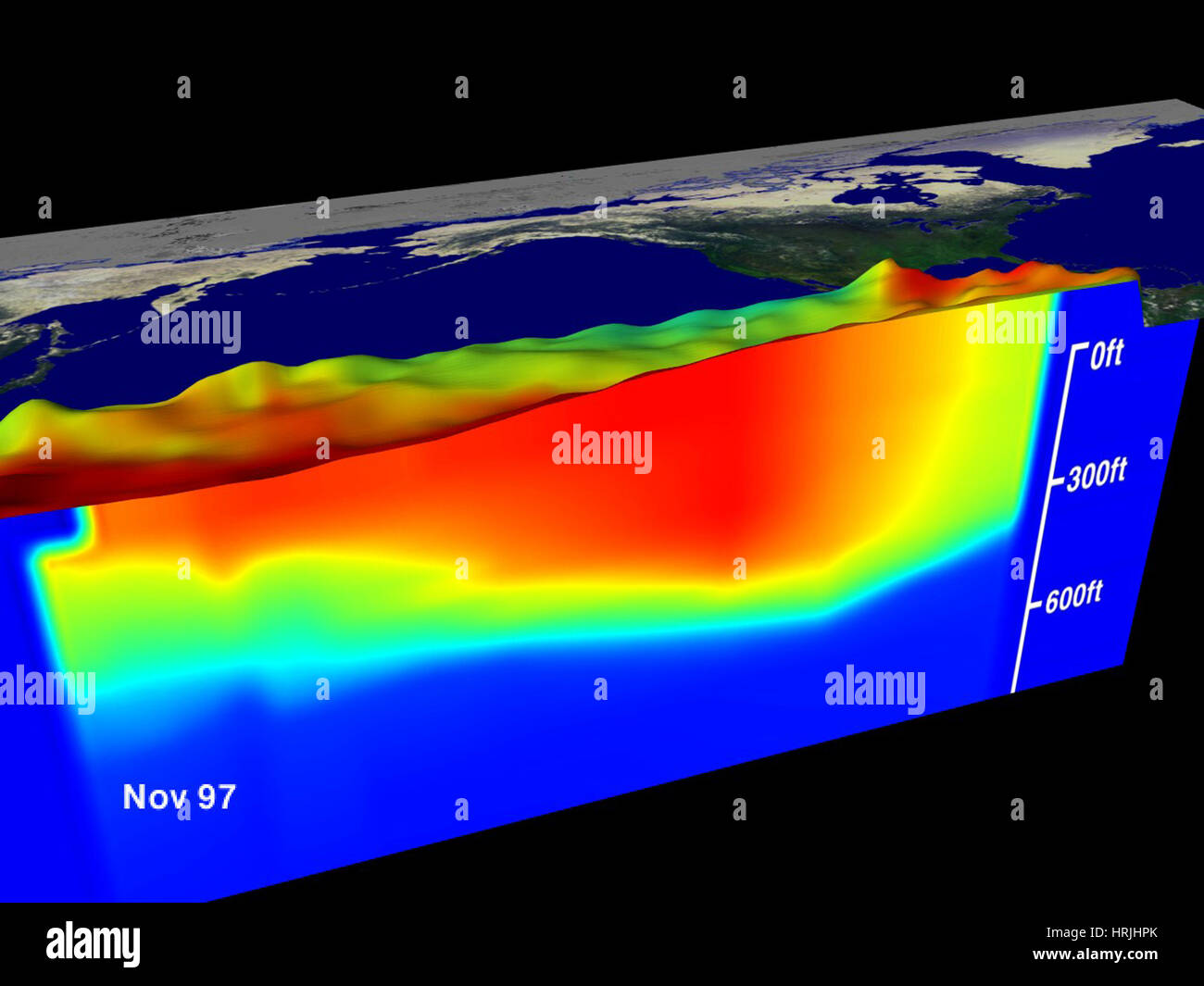
Views of sea surface height (represented by the bumps) and sea temperature (represented by the color). Red is 30 degrees C, blue is 8 degrees C. The thermocline is the border between the dark blue at the bottom and the cyan. The thermocline exists at 20 degress C. The El Ni̱o phenomenon is thought to be triggered when the steady westward blowing trade winds weaken and even reverse direction. This change in the winds allows a large mass of warm water (the red and white areas) that is normally located near Australia to move eastward along the equator until it reaches the coast of South America. The displacement of so much warm water affects evaporation, where rain clouds form and, consequently, alters the typical atmospheric jet stream patterns around the world. Using these global data, limited regional measurements from buoys and ships, and a forecasting model of the ocean-atmospheric system, the National Centers for Environmental Prediction (NCEP) of the National Oceanic and Atmospheric Administration (NOAA) has issued an advisory indicating the presence of a strong El Ni̱o condition throughout the winter. . Launched on August 10, 1992, TOPEX/Poseidon was a joint satellite mission between NASA, the U.S. space agency, and CNES, the French space agency, to map ocean surface topography.