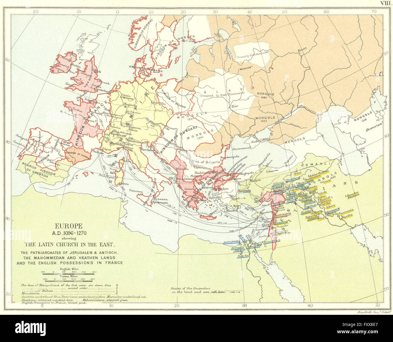
RELIGIOUS EUROPE 1096-1270: Latin Church Patriarchates Monasteries, 1897 map
RFID:Image ID:FXX8E7
Image details
Contributor:
Antiqua Print Gallery / Alamy Stock PhotoImage ID:
FXX8E7File size:
19 MB (1.6 MB Compressed download)Releases:
Model - no | Property - noDo I need a release?Dimensions:
2879 x 2308 px | 24.4 x 19.5 cm | 9.6 x 7.7 inches | 300dpiDate taken:
1897Location:
EuropeMore information:
This image could have imperfections as it’s either historical or reportage.
'Europe A.D. 1096-1270 shewing the Latin Church in the East. The Patriarchates of Jerusalem & Antioch. The Mahommedan and Heathen Lands and the English Possessions in France'. Artist/engraver/cartographer: Engraved by Stanford's Geographical Estabt. Provenance: "Historical Church Atlas", by Edmund McClure, M.A.; Published by Society for Promoting Christian Knowledge, London. Type: Coloured antique map.