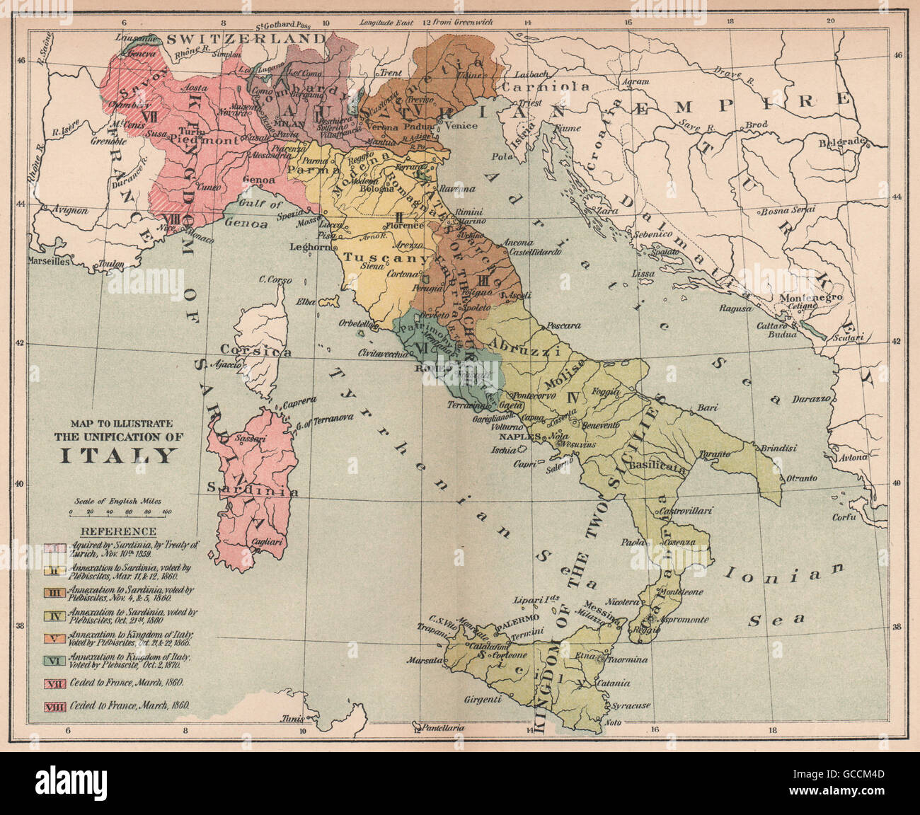
UNIFICATION OF ITALY. Acquisitions & annexations 1859-1870, 1910 antique map
RFID:Image ID:GCCM4D
Image details
Contributor:
Antiqua Print Gallery / Alamy Stock PhotoImage ID:
GCCM4DFile size:
17.8 MB (1.5 MB Compressed download)Releases:
Model - no | Property - noDo I need a release?Dimensions:
2761 x 2257 px | 23.4 x 19.1 cm | 9.2 x 7.5 inches | 300dpiDate taken:
1910Location:
ItalyMore information:
This image could have imperfections as it’s either historical or reportage.
'Map to Illustrate The Unification of Italy'. Artist/engraver/cartographer: Unsigned. Provenance: "Europe Since 1815"; Edited by Charles Downer Hazen, Published by Henry Holt & Company, New York. Type: Antique colour map.