NASALandsat Image Gallery Home About News How Landsat Helps Education Images Data Landsat 8 Landsat 9 Search the gallery... search acquired February
Image details
Contributor:
LWM/NASA/LANDSAT / Alamy Stock PhotoImage ID:
KD08MRFile size:
40 MB (1.3 MB Compressed download)Releases:
Model - no | Property - noDo I need a release?Dimensions:
4500 x 3104 px | 38.1 x 26.3 cm | 15 x 10.3 inches | 300dpiDate taken:
24 February 2015More information:
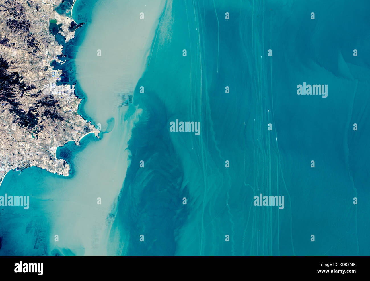
NASALandsat Image Gallery Home About News How Landsat Helps Education Images Data Landsat 8 Landsat 9 Search the gallery... search acquired February 24, 2015 Shipping Superhighways Downloads yellowsea_oli_2015055_lrg.jpg (4896x6528, JPEG) yellowsea_oli_2015055_geo.tif (4896x6528, GeoTIFF) Metadata Sensor(s): Landsat 8 - OLI Data Date: February 24, 2015 Visualization Date: March 4, 2015 facebook twitter stumbleupon Google+ pinterest The oceans may be vast, yet they still can grow crowded. Some congested areas have enough ship traffic that the International Maritime Organization (IMO) and other groups maintain traffic separation schemes—the equivalent of highways for ships—to reduce the risk of collisions. The Operational Land Imager (OLI) on Landsat 8 captured this view of northbound and southbound shipping lanes off the coast of China’s Shandong Peninsula on February 24, 2015. The lanes form one of the main routes from the Yellow Sea into the Bohai Sea and the Chinese ports of Dalian and Tianjin, two of the busiest in the world. As shown by this map, several lanes of traffic intersect northeast of the Shandong Peninsula. The vessels in this image are most likely cargo ships, though some may be ferries or fishing boats. The ships appear as small gray and white specks. (Click on the image for a closer view.) In the shallow coastal waters, their propellers kick up long, brown sediment plumes. Most of the northbound ships make a turn to the northwest as they round the tip of Shangdong. According to the IMO, the practice of following predetermined routes for shipping originated in 1898. It was first adopted by shipping companies operating passenger ships across the North Atlantic. Since then, traffic separation schemes have been established in most congested areas, causing the number of ship collisions and groundings to drop dramatically. But with upwards of 86, 000 merchant ships on the world’s sea, accidents still happen. On May 2, 2010, the Bright Ce