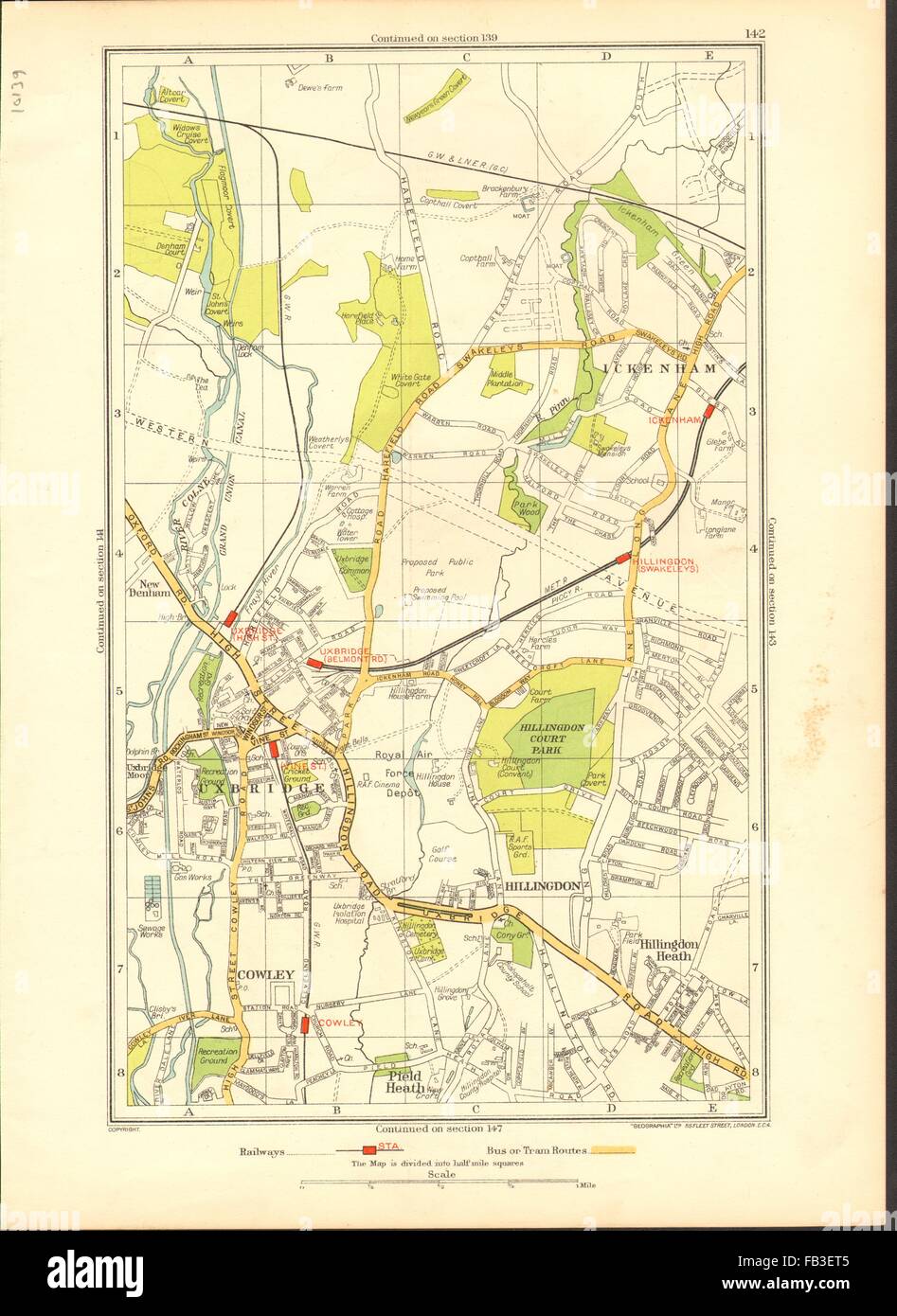
UXBRIDGE: Ickenham, Hillingdon, Ruislip, Cowley, New Denham, 1937 vintage map
Image details
Contributor:
Antiqua Print Gallery / Alamy Stock PhotoImage ID:
FB3ET5File size:
33.4 MB (1.5 MB Compressed download)Releases:
Model - no | Property - noDo I need a release?Dimensions:
2919 x 4003 px | 24.7 x 33.9 cm | 9.7 x 13.3 inches | 300dpiDate taken:
1937Location:
MiddxMore information:
This image could have imperfections as it’s either historical or reportage.
Artist/engraver/cartographer: The Geographia map company. Provenance: "The Authentic map directory of London and suburbs", fourth edition, edited by James Bain, FRGS, published by Geographia Ltd. Type: Colour vintage street atlas map. Map section #142 This map is one section from a 1937 Street Atlas of Greater London. This section of the map depicts the following suburbs in 1937: Cowley, Uxbridge, Middlesex, Hillingdon, Uxbridge, Middlesex, Hillingdon Heath., Uxbridge, Middlesex, Ickenham, Uxbridge, Middlesex , New Denham, Bucks, Pield Heath, Uxbridge, Mdx, Uxbridge, Middlesex The maps in this series show London during the rapid interwar suburban expansion. Many areas shown in the outer suburbs as undeveloped land on these maps are now built up. Less frequently, some maps indicate housing developments proposed in 1937 but which were never built on land which is still undeveloped, or which has been built up according to a different street layout from that shown. The inner London maps in this series show London before the damage inflicted by the Blitz during World War 2 and the subsequent redevelopment of the 1950's and 1960's. These maps predate the construction of any motorways (the M1 sections into London having opened between 1966-1977), many major roads, and other post-war urban traffic schemes. The elevated sections of many major roads were constructed after the second world war; for example, the maps predate the construction of the Westway and elevated sections of the A4; the Western Avenue is shown on map sections #142 & #143 as proposed or under construction to the west of Northolt Aerodrome. The London docklands are shown at the height of their scale and glory, a network of large docks and railway lines. The last dock to be built had been completed in 1921. The prosperity of the docklands continued until the advent of containerisation 1960's, whereafter they remained derelict until redevelopment commenced in the early 1980's, centred around the area now known