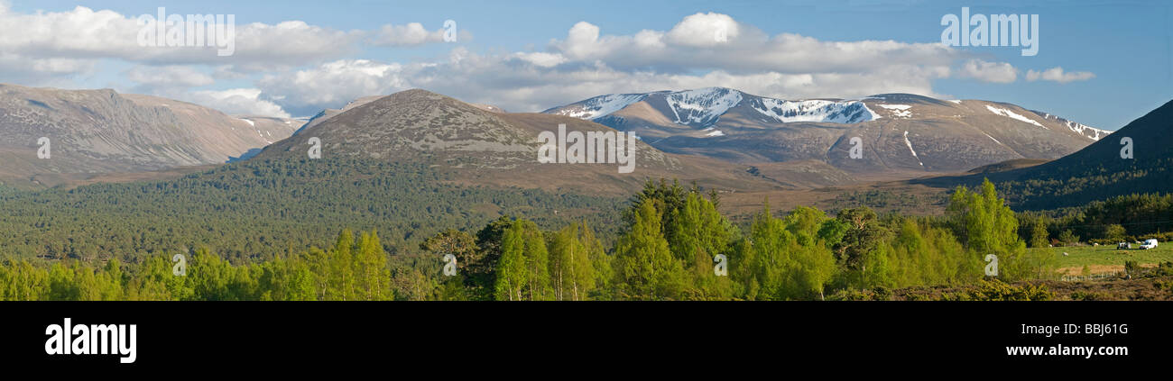
Panoramic view of Braeriach and the Lairig Ghru in the Cairngorms National Park
Image details
Contributor:
David Gowans / Alamy Stock PhotoImage ID:
BBJ61GFile size:
60 MB (2.8 MB Compressed download)Releases:
Model - no | Property - noDo I need a release?Dimensions:
9037 x 2321 px | 76.5 x 19.7 cm | 30.1 x 7.7 inches | 300dpiDate taken:
2009Location:
Tullochgru Rothiemurchus Aviemore Inverness-shire Highland Region ScotlandMore information:
The Cairngorms National Park (Scottish Gaelic Pàirc Nàiseanta a' Mhonaidh Ruaidh) is a national park in north east Scotland, established in 2003. It was the second of two national parks established by the Scottish Parliament, after Loch Lomond and the Trossachs National Park, set up in 2002. The park covers the Cairngorms range of mountains, and surrounding hills. Initially the largest national park in the British Isles, there are plans to expand the park into highland Perth and Kinross The Cairngorms National Park covers an area of 3, 800 km² (1, 467 sq miles) in Aberdeenshire, Moray, Highland and Angus Regions. The Cairngorm Mountains are a spectacular and unique wilderness. Recognised as a Special Area of Conservation, the area is managed to protect the natural environment while encouraging enjoyment through activities and family attractions. Aviemore is the busy and popular holiday destination most people have heard of but Dalwhinnie, Newtonmore and Kingussie are worth spending some time in as you enter the park from the south. Highland Wildlife Park and Dalwhinnie Single Malt lie within the National Park. The Area is a hotspot of ice climbers especially in the northern corries. It even has the world's hardest ice climb "the hurting" grade Before the National Park was established in 2003, Scottish Natural Heritage conducted a consultation exercise, considering the boundary and the powers and structure of the new park authority.