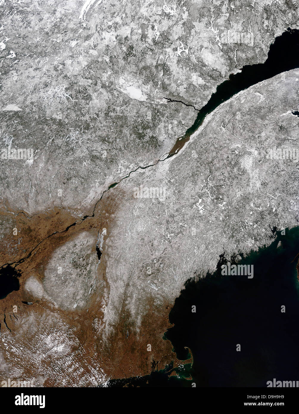
Satellite view of a frosty landscape across northern New England and eastern Canada.
Image details
Contributor:
Stocktrek Images, Inc. / Alamy Stock PhotoImage ID:
D9H9H9File size:
51.3 MB (4.1 MB Compressed download)Releases:
Model - no | Property - noDo I need a release?Dimensions:
3721 x 4815 px | 31.5 x 40.8 cm | 12.4 x 16.1 inches | 300dpiDate taken:
3 April 2011Photographer:
Stocktrek ImagesMore information:
April 3, 2011 - Satellite view of a frosty landscape across northern New England and eastern Canada. The broad St. Lawrence River appears nearly black due to the low reflectance of light from the surface of the water. Where the St. Lawrence narrows, the city of Quebec, Canada can be seen as a grayish –white area distinct from the snow surrounding it. Further south, the St. Lawrence forms the boundary between Canada and the United States as it empties into Lake Ontario. In the United States, eight states can be seen. From the north and east, they are: Maine, New Hampshire, Vermont, New York and Massachusetts, all carring a distinct snow cover. Rhode Island, Connecticut and Pennsylvania appear to be mostly snow-free.