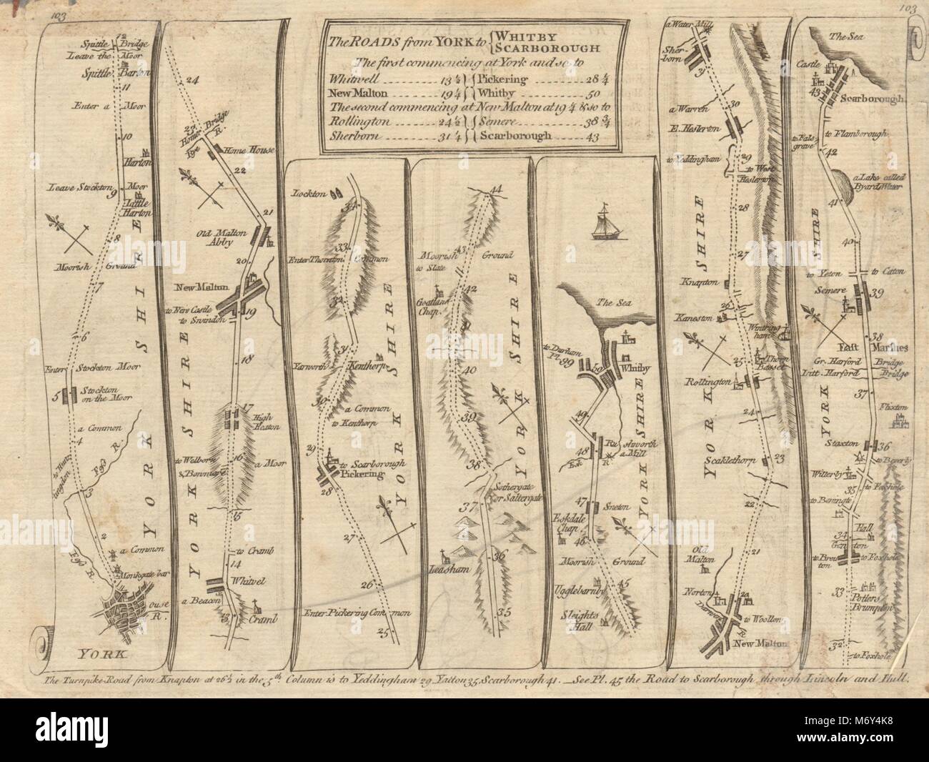
York Malton Pickering Whitby Sherburn Scarborough. KITCHIN road map 1767
Image details
Contributor:
Antiqua Print Gallery / Alamy Stock PhotoImage ID:
M6Y4K8File size:
14.2 MB (788 KB Compressed download)Releases:
Model - no | Property - noDo I need a release?Dimensions:
2574 x 1934 px | 21.8 x 16.4 cm | 8.6 x 6.4 inches | 300dpiDate taken:
1767Location:
YorkshireMore information:
This image could have imperfections as it’s either historical or reportage.
Artist/engraver/cartographer: Thomas Kitchin. Provenance: "Kitchin's Post-Chaise Companion Through England & Wales", by Thomas Kitchin. London. Printed for Robert Sayer, at No. 53 in Fleet Street; John Bowles in Cornhill; and Carington Bowles, at No 69, in St Paul's Church-yard 1767. Type: Antique engraved copperplate road strip map. The map shows the route passing through the following towns: York - Stockton on the Forest - Barton Hill - Whitwell-on-the-Hill - Malton - Old Malton - Pickering - Lockton - Levisham - Goatland - Sneaton - Whitby - Malton - Scagglethrope - Rilington - East Helerston - Sherburn - Ganton - Staxton - Seamer - Scarborough, and the following counties: Yorkshire