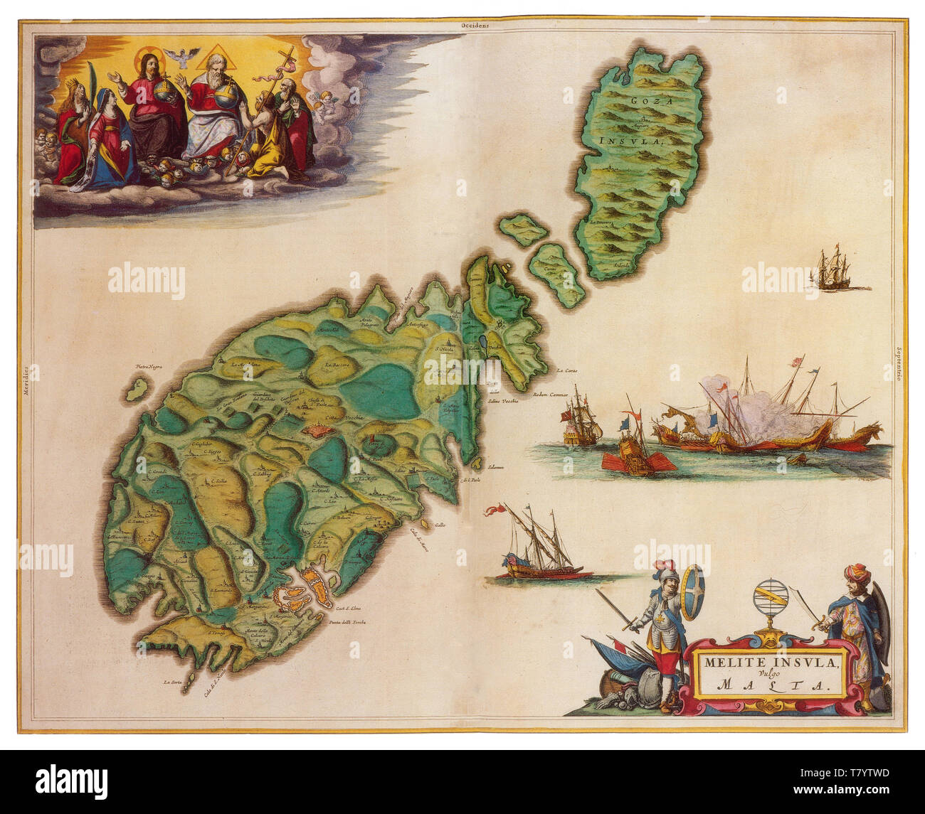
Joan Blaeu, Malta Map, 17th Century
Image details
Contributor:
Science History Images / Alamy Stock PhotoImage ID:
T7YTWDFile size:
39.5 MB (3.1 MB Compressed download)Releases:
Model - no | Property - noDo I need a release?Dimensions:
4125 x 3349 px | 34.9 x 28.4 cm | 13.8 x 11.2 inches | 300dpiDate taken:
20 April 2018Photographer:
Science History ImagesMore information:
This image could have imperfections as it’s either historical or reportage.
Malta is a Southern European island country consisting of an archipelago in the Mediterranean Sea. Malta has been inhabited since approximately 5900 BC. Its location in the centre of the Mediterranean has historically given it great strategic importance as a naval base, with a succession of powers having contested and ruled the islands, including the Phoenicians, Carthaginians, Romans, Byzantines, Arabs, Normans, Sicilians, Spanish, Knights of St. John, French, and British. Joan Blaeu (September 23, 1596 - December 21, 1673) was a Dutch cartographer born in Alkmaar, the son of cartographer Willem Blaeu. In 1620 he became a doctor of law but he joined the work of his father. In 1635 they published the Atlas Novus (full title: Theatrum orbis terrarum, sive, Atlas novus) in two volumes. The Atlas Maior is the final version of Joan Blaeu's atlas, published in Amsterdam between 1662 and 1672, in Latin, French, Dutch, German and Spanish, containing 594 maps and around 3, 000 pages of text. The Blaeu maps emphasized fine art and colors, being the most expensive of the time. The Atlas Maior is widely considered a masterpiece of the Golden Age of Dutch/Netherlandish cartography.