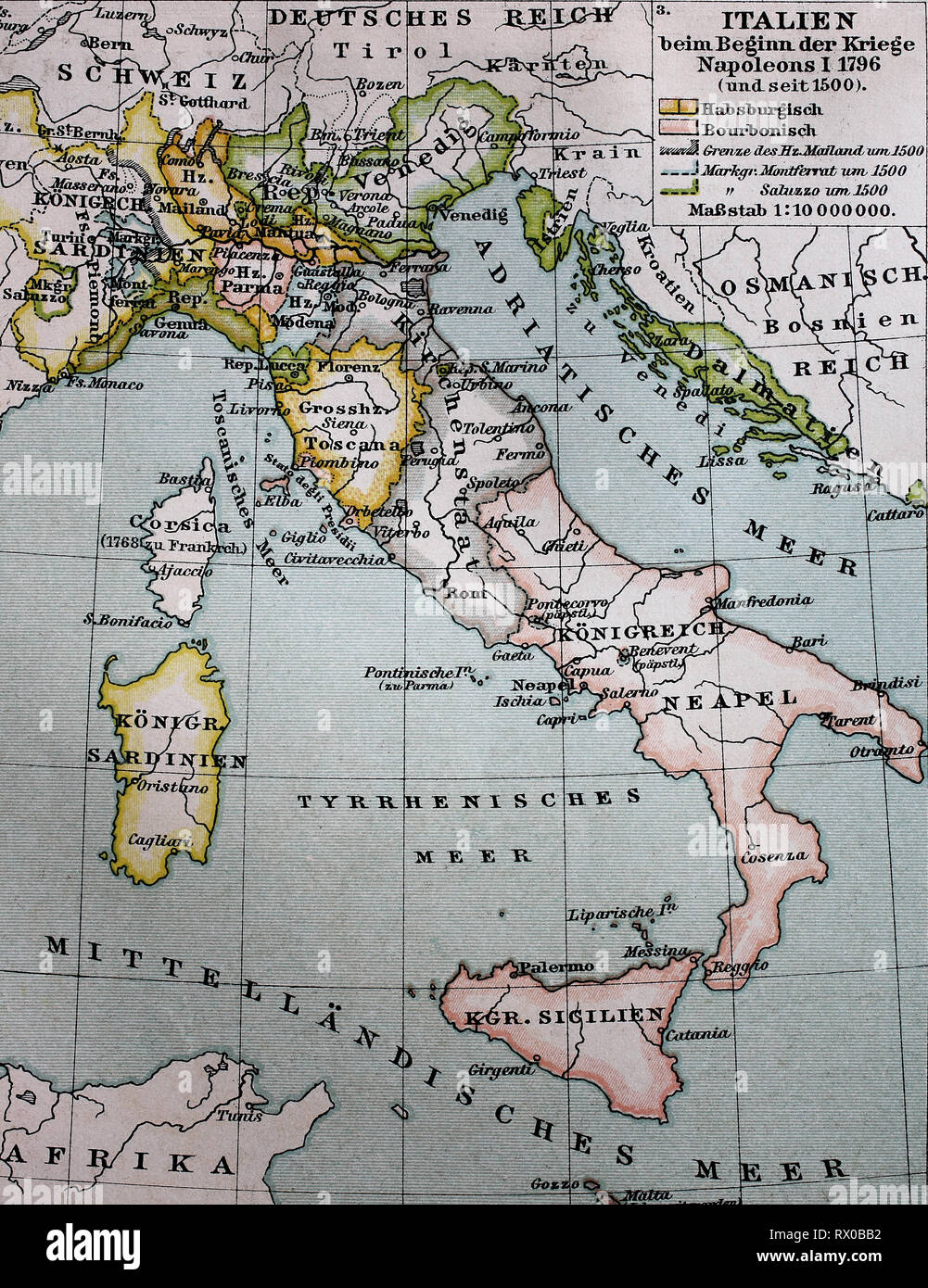
Landkarte von Italien von 1500 bis bei Beginn der Kriege Napoleon I, 1796 / Map of Italy from 1500 until the beginning of the Napoleonic Wars, 1796
RFID:Image ID:RX0BB2
Image details
Contributor:
Sunny Celeste / Alamy Stock PhotoImage ID:
RX0BB2File size:
29.6 MB (2.9 MB Compressed download)Releases:
Model - no | Property - yesDo I need a release?Dimensions:
2824 x 3664 px | 23.9 x 31 cm | 9.4 x 12.2 inches | 300dpiDate taken:
1796Location:
worldMore information:
This image could have imperfections as it’s either historical or reportage.