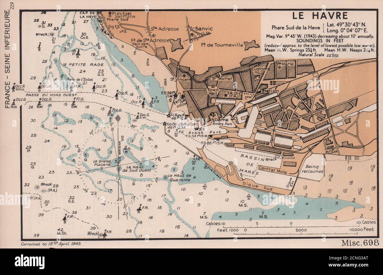
Le Havre town plan & sea coast chart. D-Day planning map. ADMIRALTY 1943
RFID:Image ID:2CNG3AT
Image details
Contributor:
Antiqua Print Gallery / Alamy Stock PhotoImage ID:
2CNG3ATFile size:
13.9 MB (778.4 KB Compressed download)Releases:
Model - no | Property - noDo I need a release?Dimensions:
2739 x 1779 px | 23.2 x 15.1 cm | 9.1 x 5.9 inches | 300dpiDate taken:
1943Location:
Seine-MaritimeMore information:
This image could have imperfections as it’s either historical or reportage.
Le Havre. Phare Sud de la Heve. Lat. 49°30' 43"N. Long. 0° 04' 07" E. mag. var. 9° 45' W. (1943) decreasing about 10' annually. Soundings in feet. Natural scale 1/44, 600. Artist/engraver/cartographer: The British Admiralty. Provenance: "English Channel Handbook": 1st Edition; Published by The Hydrographic Department of the Admiralty. Type: Vintage colour sea chart.