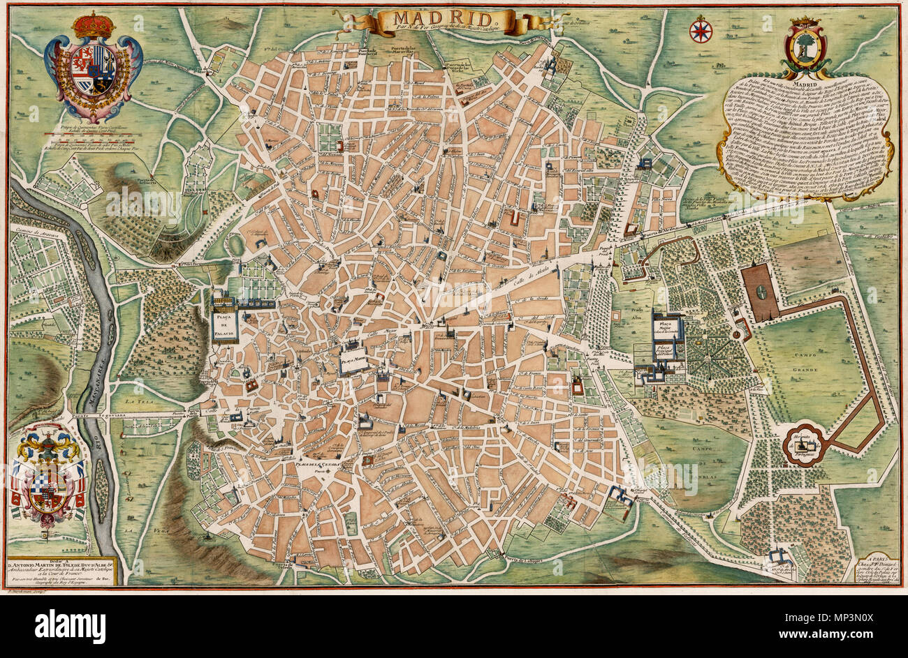
Madrid . English: Decorative large plan of Madrid, originally issued by Nicolas De Fer and published in Paris by his son in law, J.F. Benard. De Fer's map of Madrid is one of the largest obtainable maps of the Spanish Capital published in the first half of the 18th Century. Embellished with two large coats of arms, the map identifies buildings, roads, plazas, churches, parks bridges, and a host of other details on a large scale, including profile views of many of the largest buildings. The plan if quite rare on the market, this being the first example we have seen on the market in nearly 20 y
Image details
Contributor:
The Picture Art Collection / Alamy Stock PhotoImage ID:
MP3N0XFile size:
14.3 MB (1.5 MB Compressed download)Releases:
Model - no | Property - noDo I need a release?Dimensions:
2760 x 1811 px | 23.4 x 15.3 cm | 9.2 x 6 inches | 300dpiDate taken:
29 December 2011More information:
This image is a public domain image, which means either that copyright has expired in the image or the copyright holder has waived their copyright. Alamy charges you a fee for access to the high resolution copy of the image.
This image could have imperfections as it’s either historical or reportage.
Madrid . English: Decorative large plan of Madrid, originally issued by Nicolas De Fer and published in Paris by his son in law, J.F. Benard. De Fer's map of Madrid is one of the largest obtainable maps of the Spanish Capital published in the first half of the 18th Century. Embellished with two large coats of arms, the map identifies buildings, roads, plazas, churches, parks bridges, and a host of other details on a large scale, including profile views of many of the largest buildings. The plan if quite rare on the market, this being the first example we have seen on the market in nearly 20 years. . circa 1705. 1009 Plano de Madrid hacia 1705