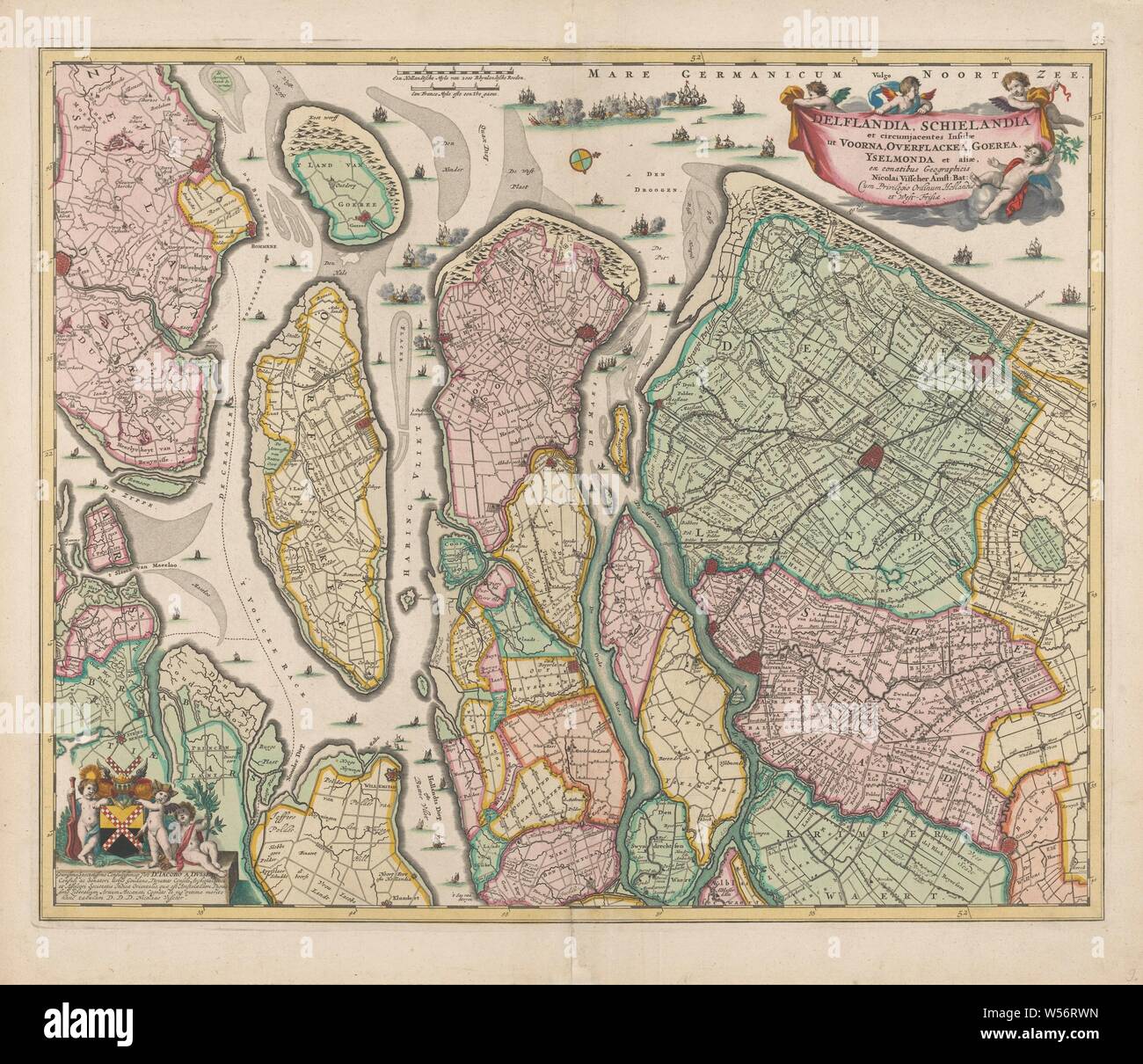
Map of South Holland, Delflandia, Schielandia and circumjacentes insulae ut Voorna, Overflackea, Gurea, Yselmonda et aliae, ex conatibus geographicis (title on object), Map from South Holland with the west above. Middle above the scale in Dutch and French miles and warships fighting in the North Sea and the mouths of Haringvliet and the Maas. Top right the title with privilege. Bottom left putti with the arms of Jacob van der Dussen with the assignment. (1: 180 000), armorial bearing, heraldry, maps of separate countries or regions, South Holland, Jacob van der Dussen, Nicolaes Visscher (I
Image details
Contributor:
Penta Springs Limited / Alamy Stock PhotoImage ID:
W56RWNFile size:
79.6 MB (5 MB Compressed download)Releases:
Model - no | Property - noDo I need a release?Dimensions:
5683 x 4897 px | 48.1 x 41.5 cm | 18.9 x 16.3 inches | 300dpiPhotographer:
ArtokoloroMore information:
This image could have imperfections as it’s either historical or reportage.
Map of South Holland, Delflandia, Schielandia and circumjacentes insulae ut Voorna, Overflackea, Gurea, Yselmonda et aliae, ex conatibus geographicis (title on object), Map from South Holland with the west above. Middle above the scale in Dutch and French miles and warships fighting in the North Sea and the mouths of Haringvliet and the Maas. Top right the title with privilege. Bottom left putti with the arms of Jacob van der Dussen with the assignment. (1: 180 000), armorial bearing, heraldry, maps of separate countries or regions, South Holland, Jacob van der Dussen, Nicolaes Visscher (I), Amsterdam, c. 1675, paper, watercolor (paint), engraving, l 46.3 cm × w 56.7 cm