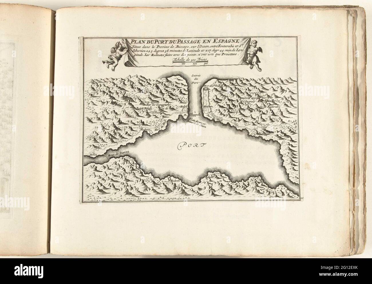
Map of the natural harbor of Puerto de Pasajes, ca. 1702; Plan du Port du Passage and Espagne; Les Forces de l'Europe, Asie, Afrique et Amerique, Ou Description des Principales Villes Avec Leurs Fortifications. Dessignées PAR LES MEILLEURS Engineers, private party Celles Qui Sont Sous La Domination de la France (...) Et Ornées the plusieurs Superbes Edifes. Map of the natural harbor of Puerto de Pasajes to the Spanish North Coast at San Sebastian. Plate No 276 In the picture in the context of a total of 276 numbered plates of renowned strong cities and fortresses in the context of the Spanish
Image details
Contributor:
BTEU/RKMLGE / Alamy Stock PhotoImage ID:
2G12EXKFile size:
17.4 MB (781.1 KB Compressed download)Releases:
Model - no | Property - noDo I need a release?Dimensions:
2960 x 2057 px | 25.1 x 17.4 cm | 9.9 x 6.9 inches | 300dpiDate taken:
4 June 2021More information:
This image is a public domain image, which means either that copyright has expired in the image or the copyright holder has waived their copyright. Alamy charges you a fee for access to the high resolution copy of the image.
This image could have imperfections as it’s either historical or reportage.
Map of the natural harbor of Puerto de Pasajes, ca. 1702; Plan du Port du Passage and Espagne; Les Forces de l'Europe, Asie, Afrique et Amerique, Ou Description des Principales Villes Avec Leurs Fortifications. Dessignées PAR LES MEILLEURS Engineers, private party Celles Qui Sont Sous La Domination de la France (...) Et Ornées the plusieurs Superbes Edifes. Map of the natural harbor of Puerto de Pasajes to the Spanish North Coast at San Sebastian. Plate No 276 In the picture in the context of a total of 276 numbered plates of renowned strong cities and fortresses in the context of the Spanish Succession War. For most part, these plates have been copied to the anonymous French plates: in Les Forces de l'Europe and in: Le Theater de la Guerre, Dans Les Pays-Bas, both originally published by Nicolas de Fer in Paris (1693-1697) in the framework of the nine-year war. Title and inscriptions in the plate in French.