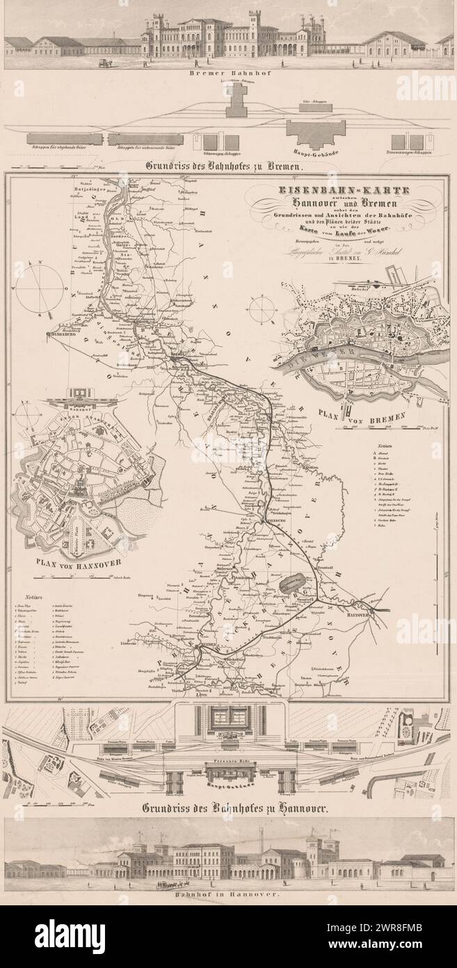
Map of the railway between Hanover and Bremen, Eisenbahn-Karte zwischen Honnover und Bremen nebst den Grundrissen (...) (title on object), Map of the railway between Hanover and Bremen. Above a view and a map of Bremen's train station. Below a view and map of Hannover train station. On the left of the map is a map of Hannover, on the right a map of Bremen., print maker: anonymous, publisher: Georg Justus Hunckel, Bremen, after 1847, paper, height 546 mm × width 292 mm, print
RMID:Image ID:2WR8FMB
Image details
Contributor:
Penta Springs Limited / Alamy Stock PhotoImage ID:
2WR8FMBFile size:
63.7 MB (3.4 MB Compressed download)Releases:
Model - no | Property - noDo I need a release?Dimensions:
3356 x 6635 px | 28.4 x 56.2 cm | 11.2 x 22.1 inches | 300dpiDate taken:
28 January 2024Photographer:
Penta SpringsMore information:
This image could have imperfections as it’s either historical or reportage.