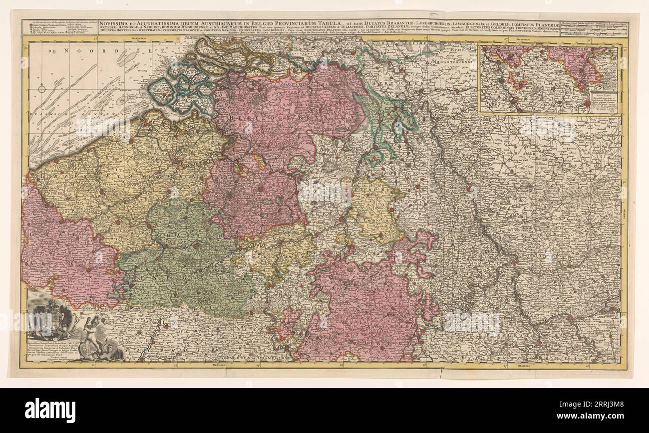
Map of the southern (Austrian) Netherlands, 1719. 'Novissima et accuratissima decem Austriacarum in Belgio provinciarum tabula, ut sunt ducatus Brabantiae, Luxembergensis, Limburgensis, et Geldriae, comitatus Flandriae'. Inset top right: part of the Duchy of Luxembourg; scale in German, Spanish and English-French miles. Bottom left: dedication to Emperor Charles VI with his coat of arms and a putto fighting a harpy.
RMID:Image ID:2RRJ3M8
Image details
Contributor:
Heritage Image Partnership Ltd / Alamy Stock PhotoImage ID:
2RRJ3M8File size:
102 MB (8 MB Compressed download)Releases:
Model - no | Property - noDo I need a release?Dimensions:
7716 x 4620 px | 65.3 x 39.1 cm | 25.7 x 15.4 inches | 300dpiPhotographer:
Heritage ImagesMore information:
This image could have imperfections as it’s either historical or reportage.