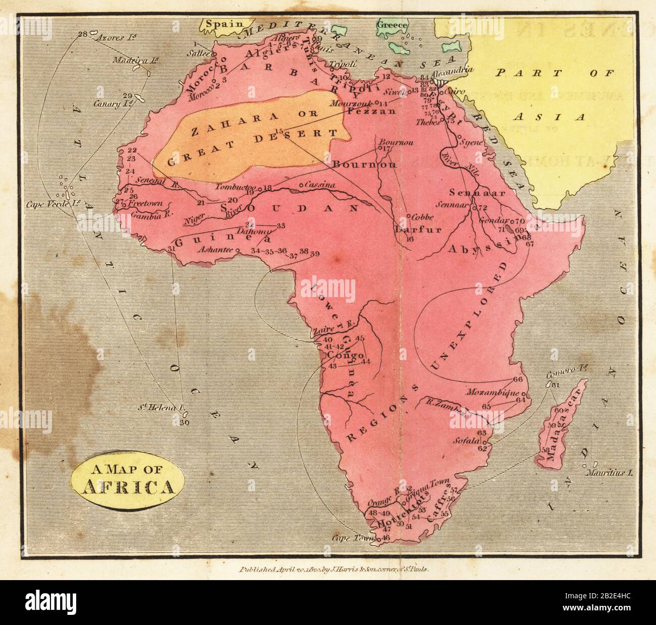
Map of Africa, 1820. Showing Morocco, Barbary and the Sahara in the north, Soudan and Guinea in the west, Khoikhoi (Hottentots) and Bantu (Caffres) in the south, and Abyssinia and Sennaar in the east.
RMID:Image ID:2B2E4HC
Image details
Contributor:
Florilegius / Alamy Stock PhotoImage ID:
2B2E4HCFile size:
83.2 MB (4.9 MB Compressed download)Releases:
Model - no | Property - noDo I need a release?Dimensions:
5733 x 5071 px | 48.5 x 42.9 cm | 19.1 x 16.9 inches | 300dpiDate taken:
1652Photographer:
FlorilegiusMore information:
This image could have imperfections as it’s either historical or reportage.