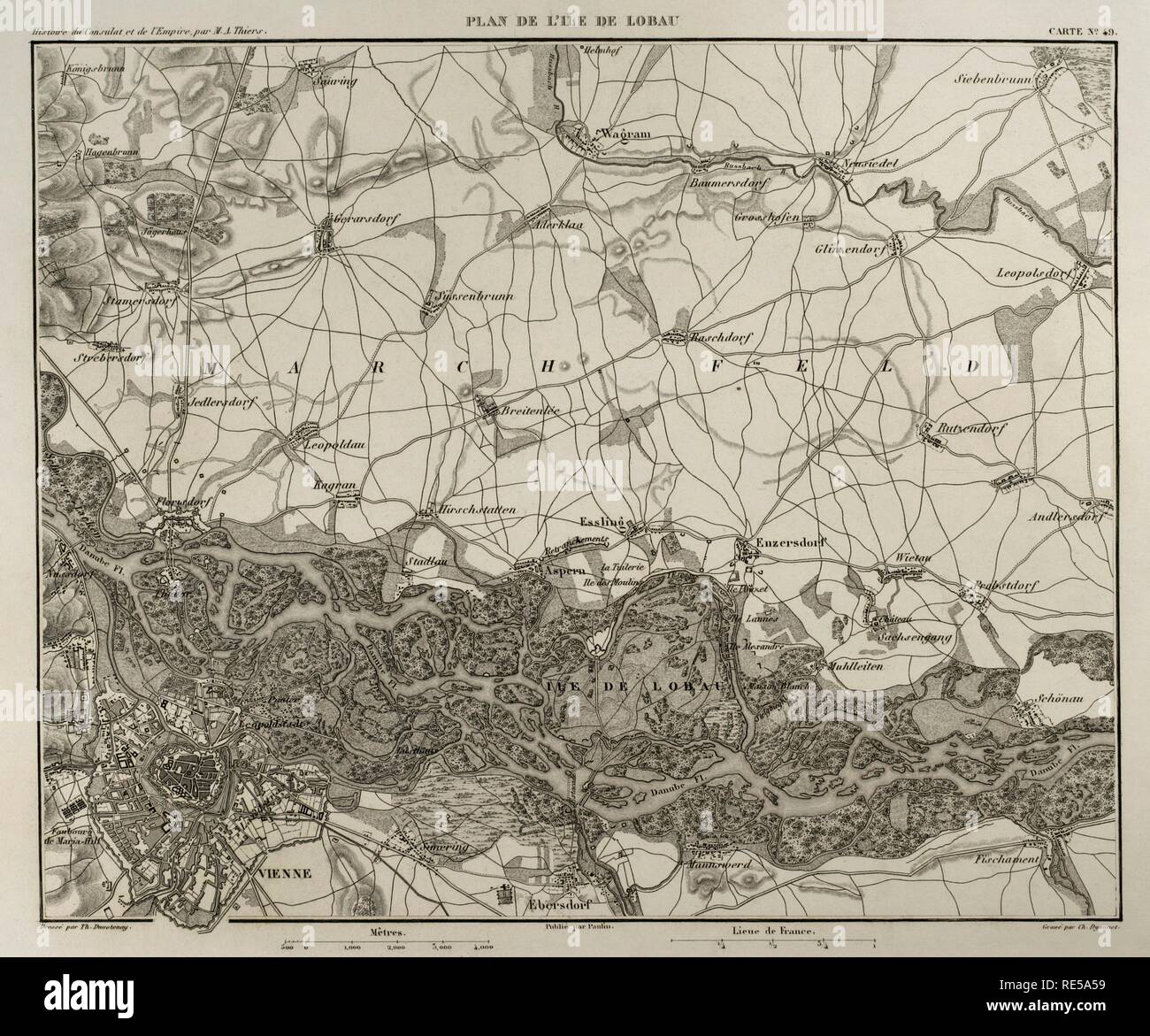
Napoleonic map. Island of Lobau (near Vienna, Austria). Battles were fought on this area during the Napoleonic Wars between Austria and France. Atlas de l'Histoire du Consulat et de l'Empire. History of the Consulate and the Empire of France under Napoleon by Marie Joseph Louis Adolphe Thiers (1797-1877). Drawings by Dufour, engravings by Dyonnet. Edited in Paris, 1864.
RMID:Image ID:RE5A59
Image details
Contributor:
Album / Alamy Stock PhotoImage ID:
RE5A59File size:
45.5 MB (2.4 MB Compressed download)Releases:
Model - no | Property - noDo I need a release?Dimensions:
4370 x 3636 px | 37 x 30.8 cm | 14.6 x 12.1 inches | 300dpiPhotographer:
AlbumMore information:
This image could have imperfections as it’s either historical or reportage.