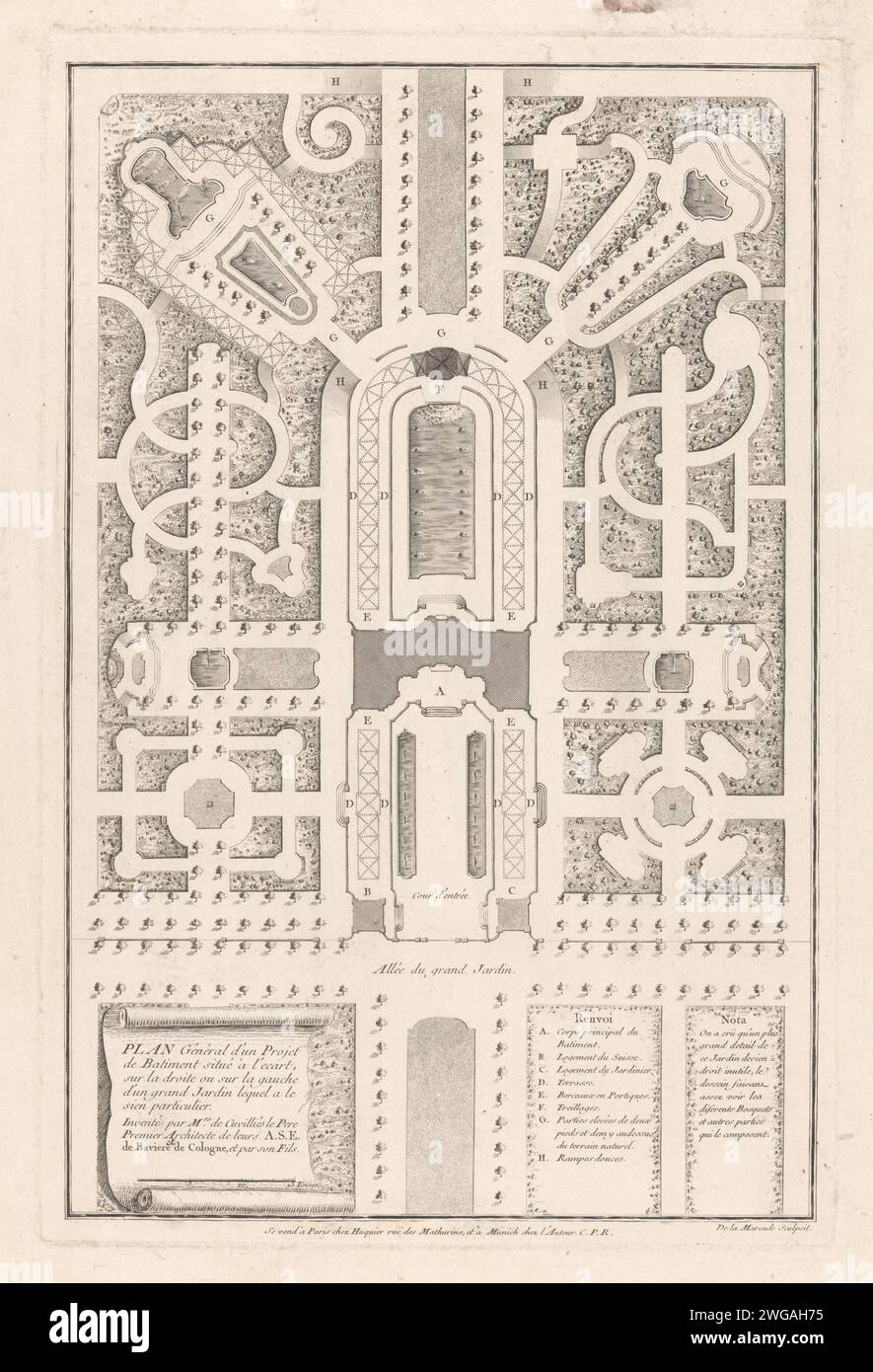
Map of Tuin, 1741 - 1768 print Map of a garden with water features in the middle and in the corners. after design by: GermanyMünchenParis paper etching / engraving plan, map of garden
RMID:Image ID:2WGAH75
Image details
Contributor:
piemags/rmn / Alamy Stock PhotoImage ID:
2WGAH75File size:
94.4 MB (5.1 MB Compressed download)Releases:
Model - no | Property - noDo I need a release?Dimensions:
4742 x 6958 px | 40.1 x 58.9 cm | 15.8 x 23.2 inches | 300dpiMore information:
This image is a public domain image, which means either that copyright has expired in the image or the copyright holder has waived their copyright. Alamy charges you a fee for access to the high resolution copy of the image.
This image could have imperfections as it’s either historical or reportage.