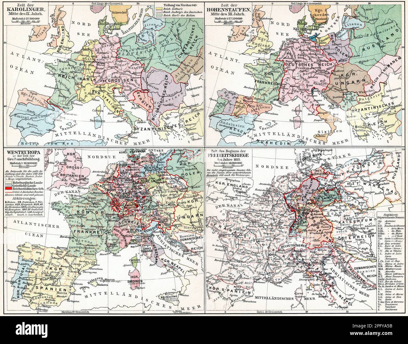
Maps of Europe during the Hohenstaufen dynasty, Carolingian dynasty, Age of Enlightenment and Napoleonic Wars. Publication of the book "Meyers Konvers
RFID:Image ID:2PFYA5B
Image details
Contributor:
Kohl-Illustration / Alamy Stock PhotoImage ID:
2PFYA5BFile size:
79.9 MB (8.5 MB Compressed download)Releases:
Model - no | Property - noDo I need a release?Dimensions:
6000 x 4655 px | 50.8 x 39.4 cm | 20 x 15.5 inches | 300dpiDate taken:
12 February 2023More information:
This image is a public domain image, which means either that copyright has expired in the image or the copyright holder has waived their copyright. Alamy charges you a fee for access to the high resolution copy of the image.
Maps of Europe during the Hohenstaufen dynasty, Carolingian dynasty, Age of Enlightenment and Napoleonic Wars. Publication of the book "Meyers Konversations-Lexikon", Volume 2, Leipzig, Germany, 1910