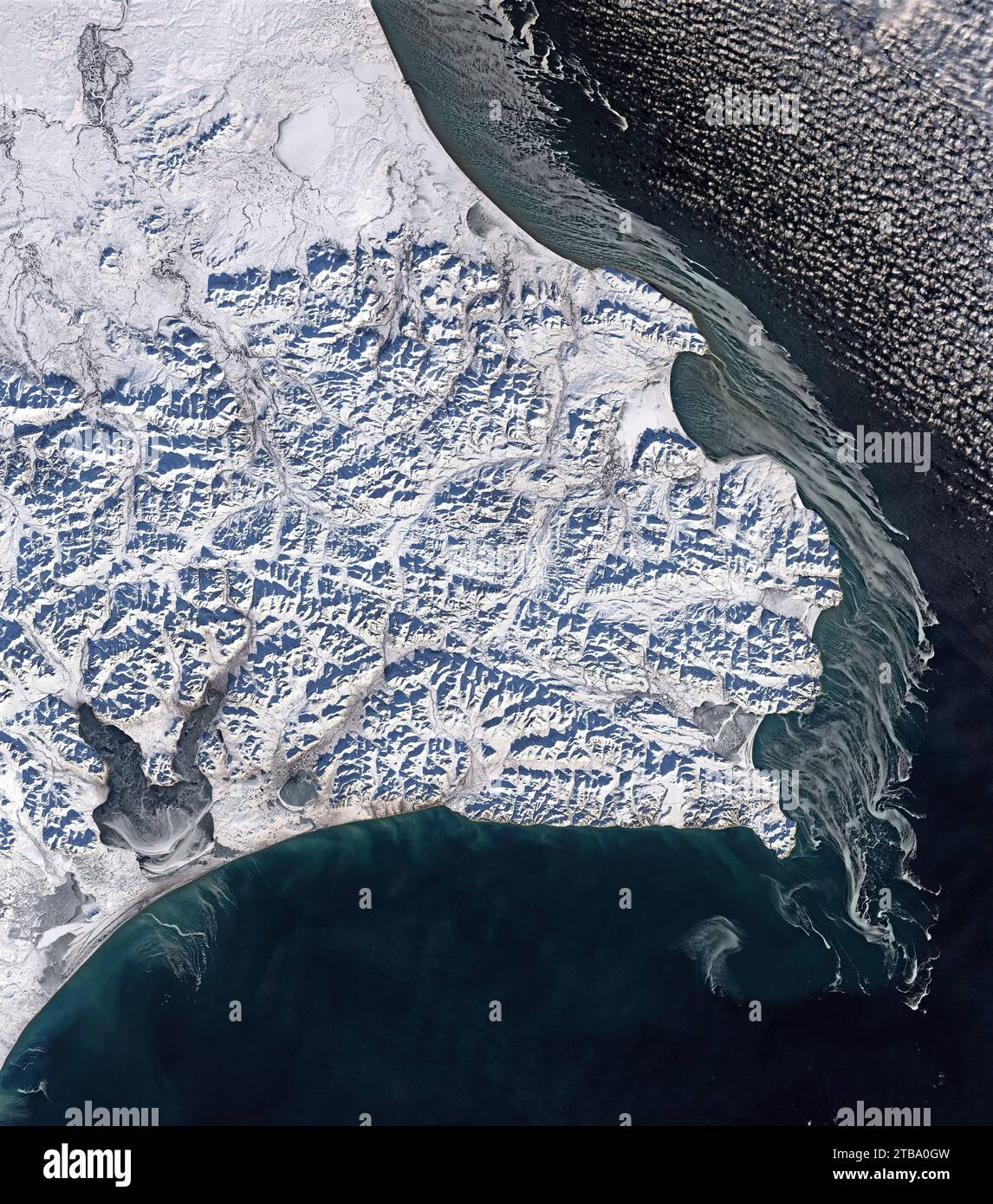
Natural color satellite view showing swirls of ice visible on Cape Navarin.
RFID:Image ID:2TBA0GW
Image details
Contributor:
Stocktrek Images, Inc. / Alamy Stock PhotoImage ID:
2TBA0GWFile size:
74.8 MB (6.7 MB Compressed download)Releases:
Model - no | Property - noDo I need a release?Dimensions:
4800 x 5445 px | 40.6 x 46.1 cm | 16 x 18.2 inches | 300dpiDate taken:
2 November 2021Photographer:
Stocktrek ImagesMore information:
This image is a public domain image, which means either that copyright has expired in the image or the copyright holder has waived their copyright. Alamy charges you a fee for access to the high resolution copy of the image.
November 2, 2021 - Natural color satellite view showing swirls of ice visible on Cape Navarin. The wide view shows the snow-covered cape, which forms the southern boundary of the Gulf of Anadyr, a large bay of the western Bering Sea.