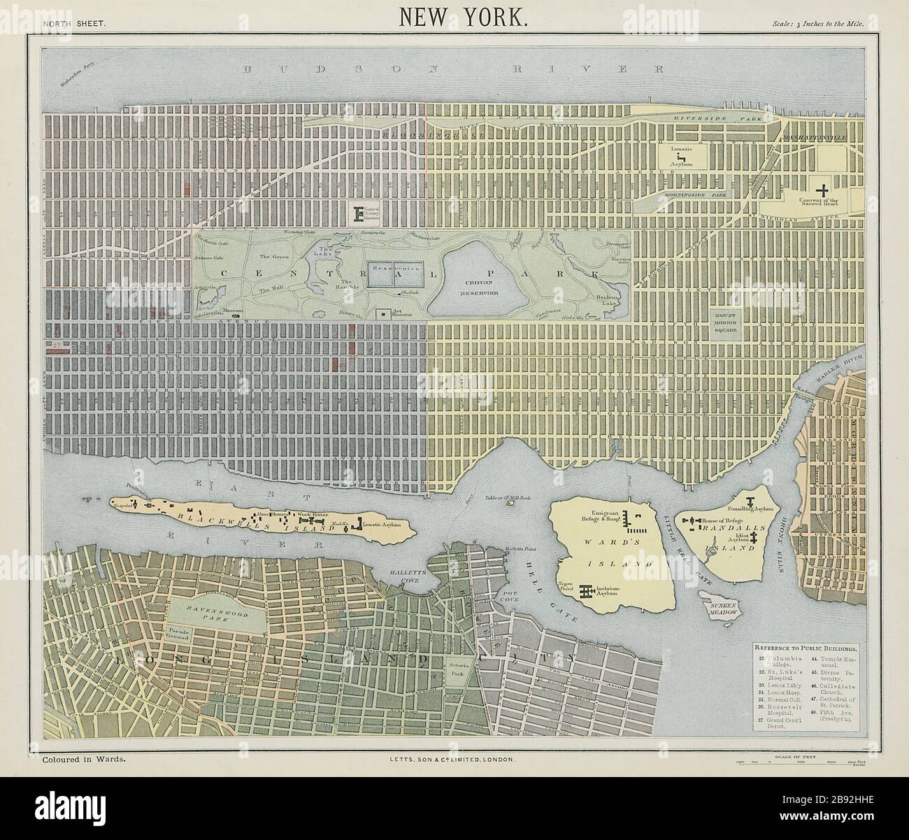
NEW YORK CITY town map plan. Lower/midtown Manhattan Brooklyn. LETTS 1884
RFID:Image ID:2B92HHE
Image details
Contributor:
Antiqua Print Gallery / Alamy Stock PhotoImage ID:
2B92HHEFile size:
58.6 MB (3.8 MB Compressed download)Releases:
Model - no | Property - noDo I need a release?Dimensions:
4893 x 4183 px | 41.4 x 35.4 cm | 16.3 x 13.9 inches | 300dpiDate taken:
1884Location:
New YorkMore information:
This image could have imperfections as it’s either historical or reportage.
New York North Sheet. Artist/engraver/cartographer: Published by Letts & Co. Most of the plates used for this atlas were original engraved for the SDUK atlas in the mid nineteenth century. The plates were later sold to Thomas Letts, and subsequently to Mason & Payne. Provenance: "Letts's Popular Atlas", published by Letts, son & Co. Limited, 33 King William Street, London Bridge, EC. Type: Antique colour atlas map.