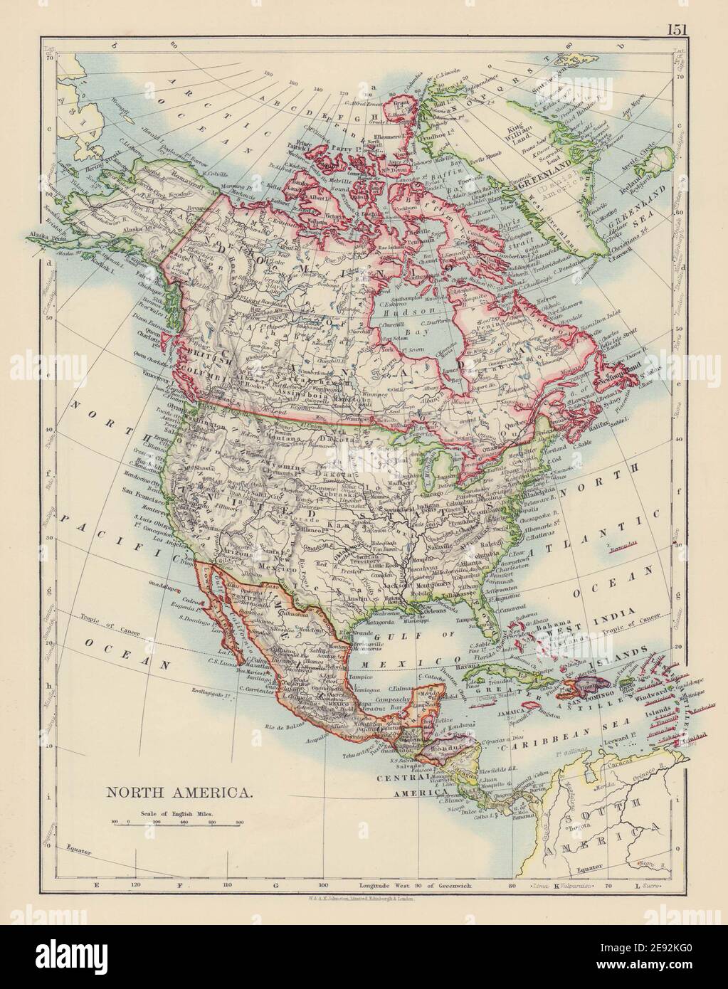
NORTH AMERICA POLITICAL. Greenland "Danish America" USA Canada Mexico 1901 map
RFID:Image ID:2E92KG0
Image details
Contributor:
Antiqua Print Gallery / Alamy Stock PhotoImage ID:
2E92KG0File size:
24.1 MB (1.1 MB Compressed download)Releases:
Model - no | Property - noDo I need a release?Dimensions:
2574 x 3268 px | 21.8 x 27.7 cm | 8.6 x 10.9 inches | 300dpiDate taken:
1901Location:
North AmericaMore information:
This image could have imperfections as it’s either historical or reportage.
North America. Artist/engraver/cartographer: W. & A.K. Johnston, Limited Edinburgh & London. Provenance: "The Victoria Atlas (formerly the Victoria Regina Atlas)"; Published by W & A.K. Johnston, Ltd, Edinburgh & London: 2nd Edition. Type: Antique colour atlas map.