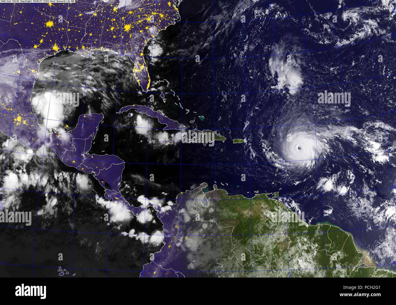
ATLANTIC OCEAN (Sept. 5, 2017) A GOES satellite image showing Hurricane Irma in the Atlantic Ocean. The storm is a category 4 hurricane on the Saffir-Simpson hurricane wind scale. Maximum sustained winds have increased to near 150 mph (240 km/h) with higher gusts. Some fluctuations in intensity are likely during the next day or two, but Irma is forecast to remain a powerful category 4 hurricane. Hurricane-force winds extend outward up to 45 miles (75 km) from the center and tropical-storm-force winds extend outward up to 140 miles (220 km). The estimated minimum central pressure is 937 mb (27.
Image details
Contributor:
Aclosund Historic / Alamy Stock PhotoImage ID:
PCH2G1File size:
5.7 MB (485.9 KB Compressed download)Releases:
Model - no | Property - noDo I need a release?Dimensions:
1690 x 1183 px | 28.6 x 20 cm | 11.3 x 7.9 inches | 150dpiDate taken:
5 September 2017More information:
This image is a public domain image, which means either that copyright has expired in the image or the copyright holder has waived their copyright. Alamy charges you a fee for access to the high resolution copy of the image.
This image could have imperfections as it’s either historical or reportage.
ATLANTIC OCEAN (Sept. 5, 2017) A GOES satellite image showing Hurricane Irma in the Atlantic Ocean. The storm is a category 4 hurricane on the Saffir-Simpson hurricane wind scale. Maximum sustained winds have increased to near 150 mph (240 km/h) with higher gusts. Some fluctuations in intensity are likely during the next day or two, but Irma is forecast to remain a powerful category 4 hurricane. Hurricane-force winds extend outward up to 45 miles (75 km) from the center and tropical-storm-force winds extend outward up to 140 miles (220 km). The estimated minimum central pressure is 937 mb (27.67 inches).