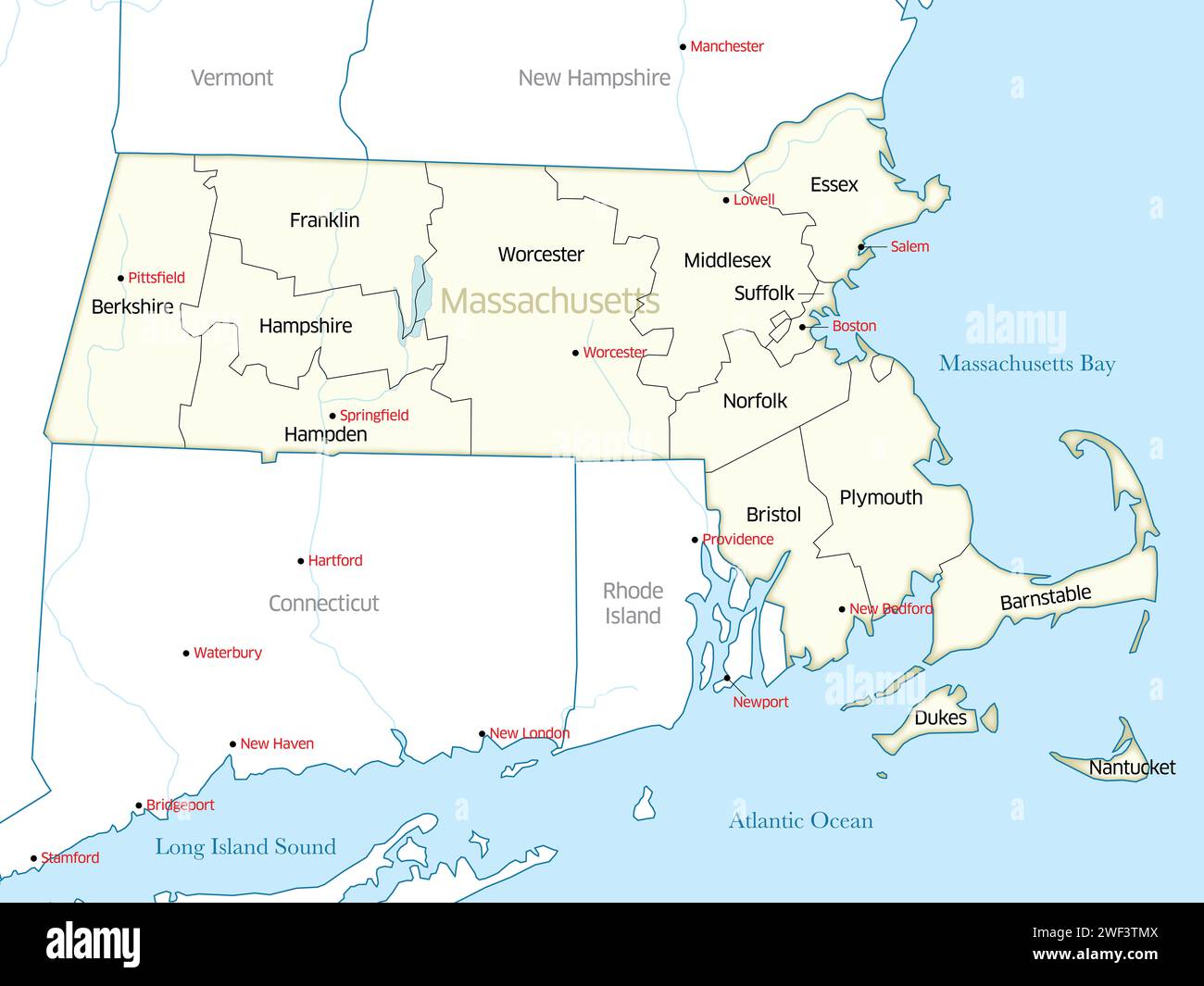
Political map showing the counties of the state of Massachusetts.
RFID:Image ID:2WF3TMX
Image details
Contributor:
Jerry Regis / Alamy Stock PhotoImage ID:
2WF3TMXFile size:
111.2 MB (1.2 MB Compressed download)Releases:
Model - no | Property - noDo I need a release?Dimensions:
7200 x 5400 px | 61 x 45.7 cm | 24 x 18 inches | 300dpiDate taken:
16 December 2023Location:
Massachusetts, United States