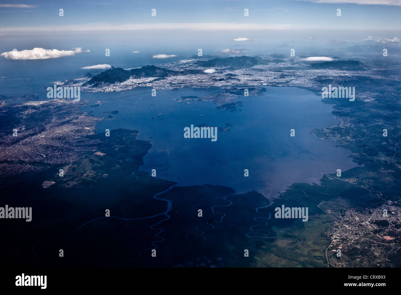
Aerial view of Guanabara Bay Rio de Janeiro Brazil
Image details
Contributor:
BrazilPhotos / Alamy Stock PhotoImage ID:
CRXB93File size:
50 MB (4 MB Compressed download)Releases:
Model - no | Property - noDo I need a release?Dimensions:
5117 x 3412 px | 43.3 x 28.9 cm | 17.1 x 11.4 inches | 300dpiDate taken:
1 December 2011Location:
Guanabara Bay Rio de Janeiro BrazilPhotographer:
Ricardo Funari / BrazilPhotosMore information:
This image could have imperfections as it’s either historical or reportage.
Guanabara Bay, oceanic bay located in Southeast Brazil in the state of Rio de Janeiro. On its western shore lies the city of Rio de Janeiro (background), and on its eastern shore the cities of Niteroi and Sao Goncalo. Four other municipalities surround the bay's shores. It is the second largest bay in area in Brazil ( after the All Saints' Bay in Bahia), at 412 square kilometres (159 sq mi), with a perimeter of 143 kilometres (89 mi). It is 31 kilometres (19 mi) long and 28 kilometres (17 mi) wide at its maximum. Its 1.5 kilometres (0.93 mi) wide mouth is flanked at the eastern tip by the Pico do Papagaio (Parrot's Peak) and the western tip by Pao de Acucar (Sugar Loaf).