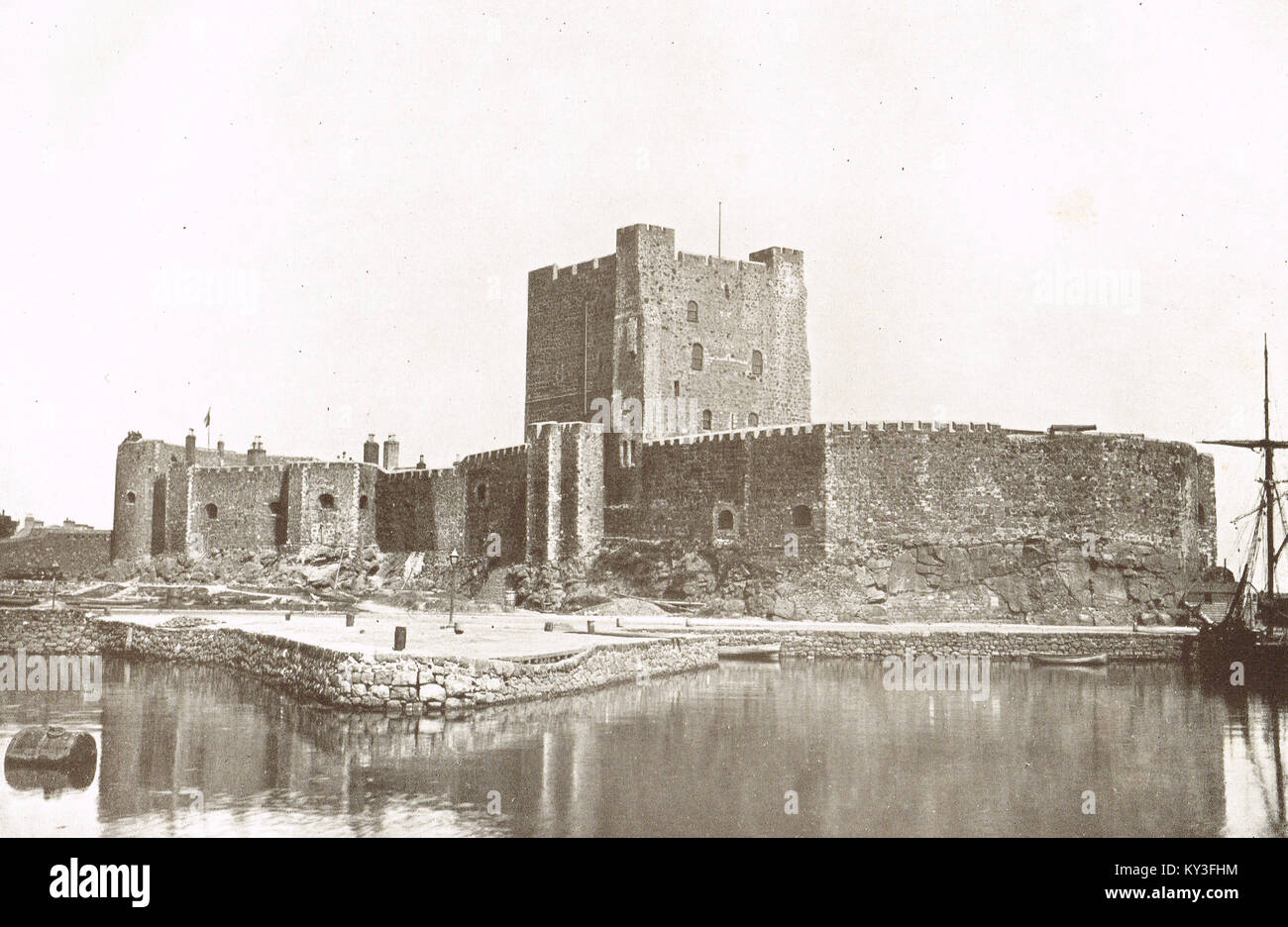
Carrickfergus castle in the early 20th century, County Antrim, Northern Ireland
Image details
Contributor:
Historical Images Archive / Alamy Stock PhotoImage ID:
KY3FHMFile size:
28.3 MB (2.4 MB Compressed download)Releases:
Model - no | Property - noDo I need a release?Dimensions:
3900 x 2539 px | 33 x 21.5 cm | 13 x 8.5 inches | 300dpiDate taken:
1919Location:
Carrickfergus Castle, Marine Highway, Carrickfergus, United KingdomMore information:
This image could have imperfections as it’s either historical or reportage.
Photograph from the History of Ulster published 1919. Robert Welch 1859-1936. Info from wiki: Carrickfergus Castle (from the Irish Carraig Ḟergus or "cairn of Fergus", the name "Fergus" meaning "strong man") is a Norman Irish castle in Northern Ireland, situated in the town of Carrickfergus in County Antrim, on the northern shore of Belfast Lough. Besieged in turn by the Scottish, Irish, English and French, the castle played an important military role until 1928 and remains one of the best preserved medieval structures in Northern Ireland. It was strategically useful, with 3/4 of the castle perimeter surrounded by water (although in modern times only 1/3 is surrounded by water due to land reclamation)