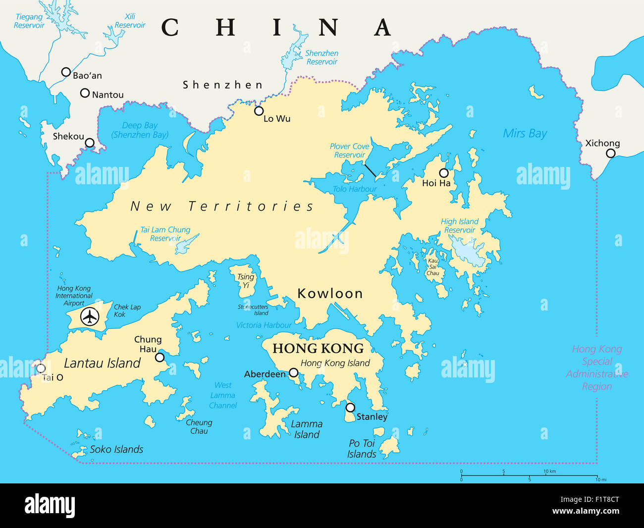
Hong Kong And Vicinity Political Map
RFID:Image ID:F1T8CT
Image details
Contributor:
Peter Hermes Furian / Alamy Stock PhotoImage ID:
F1T8CTFile size:
137.2 MB (2.4 MB Compressed download)Releases:
Model - no | Property - noDo I need a release?Dimensions:
7991 x 6000 px | 67.7 x 50.8 cm | 26.6 x 20 inches | 300dpiDate taken:
7 September 2015Location:
China, Hong KongMore information:
Hong Kong and vicinity political map. World financial Centre and Special Administrative Region in Guangdong Province of China. English labeling and scaling. Illustration.