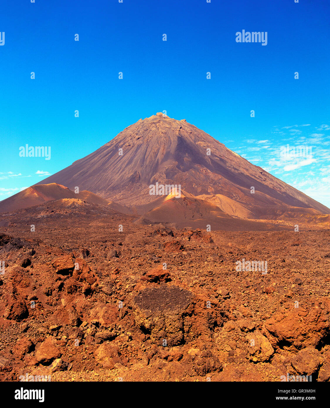
Pico de Fogo. Fogo, Cape Verde Islands, Africa.
RMID:Image ID:GR3M0H
Image details
Contributor:
Matthew Wakem / Alamy Stock PhotoImage ID:
GR3M0HFile size:
59.9 MB (4.8 MB Compressed download)Releases:
Model - no | Property - noDo I need a release?Dimensions:
4260 x 4916 px | 36.1 x 41.6 cm | 14.2 x 16.4 inches | 300dpiDate taken:
22 January 2008More information:
Pico de Fogo. Fogo, Cape Verde Islands, Africa. Pico do Fogo pronounced [ˈpiku du ˈfoɡu] is the highest peak of Cape Verde, rising to 2, 829 metres above sea level. It is an active stratovolcano lying on the island of Fogo. The main cone last erupted in 1675, causing mass emigration from the island, while a subsidiary vent erupted in 1995. The only deadly eruption was in 1847 when earthquakes generated in all the island claimed several lives. The mountain's slopes are used to grow coffee, while its lava is used as building material. Near its peak is a caldera and a small village, Chã das Caldeiras, is inside this caldera.