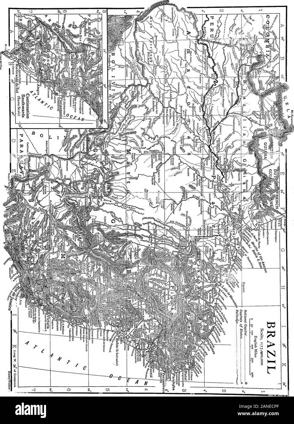
The encyclopdia britannica; a dictionary of arts, sciences, literature and general information . ccession of falls and rapids. There remains only the elevated valley of the Parahyba do Sul,lying between the so-called Serra das Vertentes of southern MinasGeraes and the Serra do Mar, and extending from the Serra daBocaina, near the city of Sao Paulo, eastward to Cape Frio and thecoastal plain north of that point. It includes a small part of easternSao Paulo, the greater part of the state of Rio de Janeiro, a smallcorner of Espirito Santo, and a narrow strip along the southernborder of Minas Gera
Image details
Contributor:
The Reading Room / Alamy Stock PhotoImage ID:
2ANECPFFile size:
7.1 MB (884.9 KB Compressed download)Releases:
Model - no | Property - noDo I need a release?Dimensions:
1361 x 1835 px | 23 x 31.1 cm | 9.1 x 12.2 inches | 150dpiMore information:
This image is a public domain image, which means either that copyright has expired in the image or the copyright holder has waived their copyright. Alamy charges you a fee for access to the high resolution copy of the image.
This image could have imperfections as it’s either historical or reportage.
The encyclopdia britannica; a dictionary of arts, sciences, literature and general information . ccession of falls and rapids. There remains only the elevated valley of the Parahyba do Sul, lying between the so-called Serra das Vertentes of southern MinasGeraes and the Serra do Mar, and extending from the Serra daBocaina, near the city of Sao Paulo, eastward to Cape Frio and thecoastal plain north of that point. It includes a small part of easternSao Paulo, the greater part of the state of Rio de Janeiro, a smallcorner of Espirito Santo, and a narrow strip along the southernborder of Minas Geraes. It is traversed by two mountain chains, the Serra da Mantiqueira and Serra do Mar, and the broad, fertilevalley of the Parahyba do Sul which lies between them, and whichslopes gently toward the east from a general elevation exceeding2000 ft. in Sao Paulo. This region is the smallest of the chapadaodivisions of the great plateau, and might be considered either asouthward extension of the Sao Francisco or an eastward extensionof the Parana chapadao. It is one of the most favoured regions of. GEOGRAPHY] BRAZIL 441 Brazil, having an abundant rainfall, extensive forests of valuabletimber, and large areas of fertile soil. The mountain slopes are stillmasses of dense forest, though their lower elevations and neighbour-ing valleys have been cleared for cultivation and by dealers inrosewood and other valuable woods. This elevated valley is notedfor its fertility and was once the principal coffee-producing districtof Brazil. Outside the two great river systems of the Amazon and riverPlate (Rio de la Plata), which are treated under their respectivetitles, the rivers of Brazil are limited to the numerous* *• small streams and three or four large rivers which floweastward from the plateau regions directly into the Atlantic. TheAmazon system covers the entire north-western part of the republic, the state of Amazonas, nearly the whole of Para and the greaterpart of Matto Grosso being drai