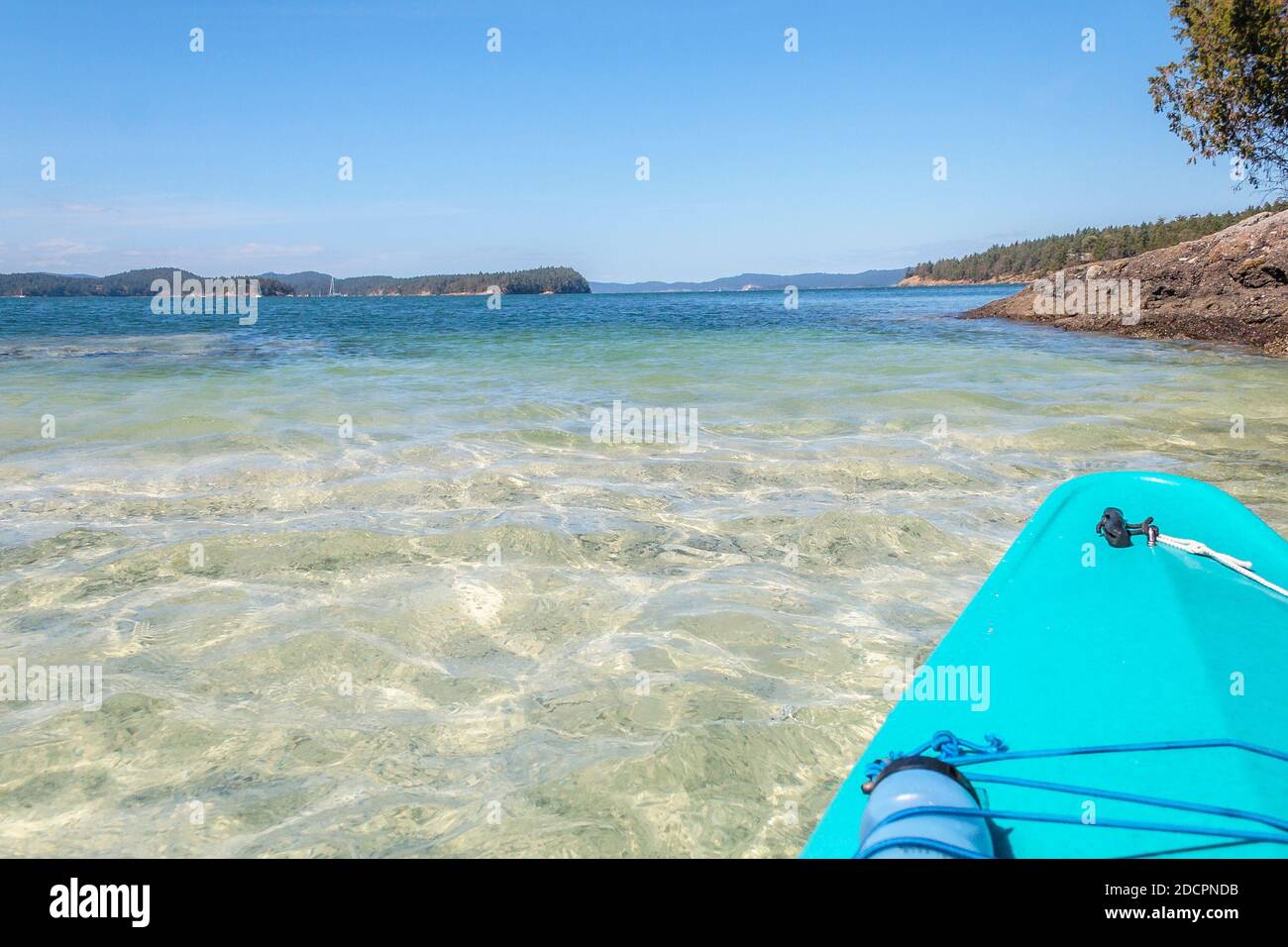
A mud and shell bottom is seen through the clear water as a kayak moves over a shallows, with deep blue water and islands beyond (British Columbia).
RFID:Image ID:2DCPNDB
Image details
Contributor:
Laurie MacBride / Alamy Stock PhotoImage ID:
2DCPNDBFile size:
17.7 MB (787.2 KB Compressed download)Releases:
Model - no | Property - noDo I need a release?Dimensions:
3046 x 2031 px | 25.8 x 17.2 cm | 10.2 x 6.8 inches | 300dpiDate taken:
27 August 2016Location:
Near Ganges, British Columbia, CanadaMore information:
The mud and shell bottom is part of a tombolo joining a small islet to a slightly larger one (visible on right foreground). The shell fragments are likely indicative of a lengthy historic use by First Nations people. The view in the distance is into Ganges Harbour on Saltspring Island, and to the right of it, looking northward up Trincomali Channel between Saltspring and Galiano Islands in British Columbia's Gulf Islands.