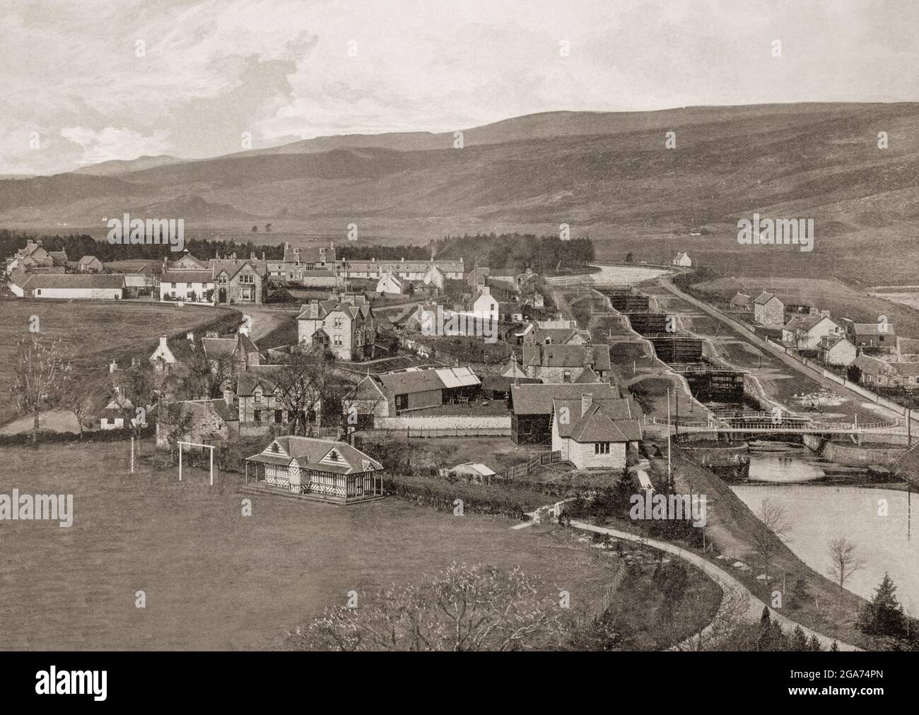
A late 19th century aerial view of Fort Augustus, located at the south-west end of Loch Ness, Scottish Highlands showing the five locks of the Caledonian Canal. Until the early 18th century the settlement was called Kiliwhimin, but was renamed Fort Augustus after the Jacobite Rising of 1715 when General Wade built a fort of which little remains. The Caledonian Canal connects the Scottish east coast at Inverness with the west coast at Corpach near Fort William in Scotland, and was constructed in the early nineteenth century by Scottish engineer Thomas Telford.
RMID:Image ID:2GA74PN
Image details
Contributor:
De Luan / Alamy Stock PhotoImage ID:
2GA74PNFile size:
40.1 MB (4 MB Compressed download)Releases:
Model - no | Property - noDo I need a release?Dimensions:
4448 x 3155 px | 37.7 x 26.7 cm | 14.8 x 10.5 inches | 300dpiDate taken:
1880Location:
Fort Augustus, at the south-west end of Loch Ness in the Scottish Highlands.More information:
This image is a public domain image, which means either that copyright has expired in the image or the copyright holder has waived their copyright. Alamy charges you a fee for access to the high resolution copy of the image.
This image could have imperfections as it’s either historical or reportage.