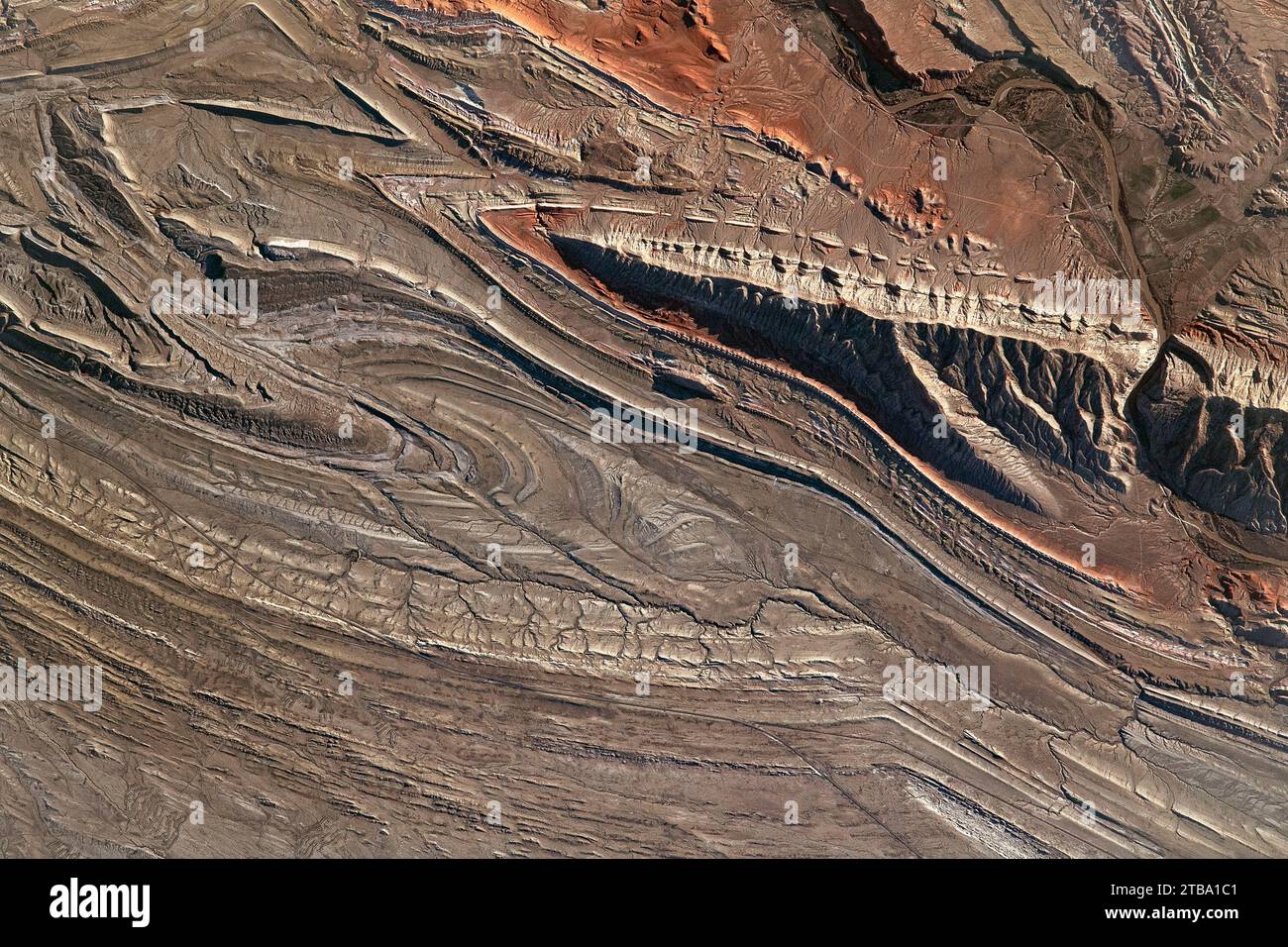
View from space showing the folds and geological structures of the northern Bighorn Basin.
Image details
Contributor:
Stocktrek Images, Inc. / Alamy Stock PhotoImage ID:
2TBA1C1File size:
72.1 MB (7.4 MB Compressed download)Releases:
Model - no | Property - noDo I need a release?Dimensions:
6150 x 4100 px | 52.1 x 34.7 cm | 20.5 x 13.7 inches | 300dpiDate taken:
6 May 2021Photographer:
Stocktrek ImagesMore information:
This image is a public domain image, which means either that copyright has expired in the image or the copyright holder has waived their copyright. Alamy charges you a fee for access to the high resolution copy of the image.
May 6, 2021 - The Bighorn River flows through much of north-central Wyoming and southern Montana, cutting through the rugged and angular terrain of the Bighorn Basin. Red rocks and complex geology are distinctive features of this physiographic region. The semi-arid climate creates a sparsely vegetated environment where dramatic geologic structures are easily identified from space and from the ground. Along the right side of this image, the Bighorn River is almost hidden amid the mountains due to the shadows cast into Sheep Canyon. Located in Wyoming's Rocky Mountains, Bighorn Basin is a large, oval-shaped depression and home to many rivers and geologic formations. This photo is centered on the Sheep Mountain anticline, a type of fold that forms due to compressional stress on rock layers. Geologic structures like this anticline are found throughout the Bighorn Basin and many are associated with oil and gas reservoirs.